Area Overview for DA7 5JH
Photos of DA7 5JH
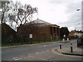
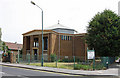
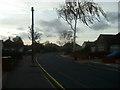
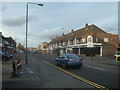
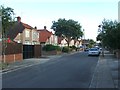
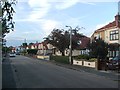
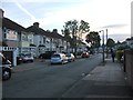
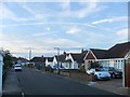
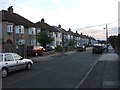

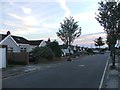
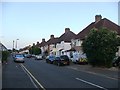
99 photos from this area
Area Information
Key information about the DA7 5JH including its size, population, and administrative classification.
- Area Type
- Postcode
- Area Size
- 6447 m²
- Population
- Not available
- Population Density
- Not available
House Prices in DA7 5JH
49
Properties
£211,279
Average Sold Price
£56,000
Lowest Price
£325,000
Highest Price
Showing 49 properties
| Address | Type | Beds | Baths | Last Sale Price | Last Sale Date | |
|---|---|---|---|---|---|---|
| 2 Melanie Close, Bexleyheath, DA7 5JH | Maisonette | 2 | 1 | £265,000 | Sep 2025 | |
| 12 Melanie Close, Bexleyheath, DA7 5JH | Maisonette | 2 | 1 | £275,000 | May 2025 | |
| 11 Melanie Close, Bexleyheath, DA7 5JH | Maisonette | 2 | 1 | £325,000 | Oct 2023 | |
| 20 Melanie Close, Bexleyheath, DA7 5JH | Retail | 2 | 1 | £246,000 | Mar 2023 | |
| 9 Melanie Close, Bexleyheath, DA7 5JH | Maisonette | 2 | 1 | £295,000 | Mar 2022 | |
| 17 Melanie Close, Bexleyheath, DA7 5JH | Maisonette | 2 | 1 | £301,000 | Jan 2022 | |
| 13 Melanie Close, Bexleyheath, DA7 5JH | Maisonette | 2 | 1 | £260,000 | Jul 2021 | |
| 19 Melanie Close, Bexleyheath, DA7 5JH | Flat | 2 | 1 | £265,000 | Mar 2021 | |
| 1 Melanie Close, Bexleyheath, DA7 5JH | Land | - | - | £180,000 | Jul 2017 | |
| 5 Melanie Close, Bexleyheath, DA7 5JH | Maisonette | 2 | 1 | £246,500 | Oct 2016 |
Page 1 of 5
Energy Efficiency in DA7 5JH
Amenities
Schools
| Rank | School | Type | Entry gender | Ages |
|---|
Explore more schools in this area
Go to Schools tabDemographics
Household Size
Family (3-5 people)
most common
Accommodation Type
Houses
most common
Tenure
64
majority
Ethnic Group
White
most common
Religion
N/A
most common
Household Composition
N/A
most common
Age
47
median
Adults (30-64 years)
most common
Household Deprivation
N/A
with no deprivation
NS-SEC
32
in Lower managerial occupations
Explore more demographic insights in this area
Go to Demographics tabPlanning
Planning Constraints
- Flood RiskPremium
- Ramsar Wetland SitesPremium
- Area of Outstanding Natural BeautyPremium
- Protected Nature ReservePremium
- Protected WoodlandPremium