Area Overview for DA7 5HP
Photos of DA7 5HP
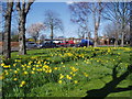
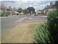
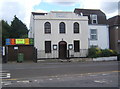
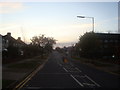
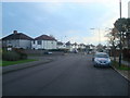
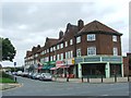
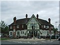
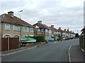
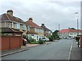
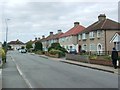
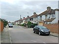
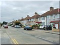
53 photos from this area
Area Information
Key information about the DA7 5HP including its size, population, and administrative classification.
- Area Type
- Postcode
- Area Size
- 1.1 hectares
- Population
- 1757
- Population Density
- 6341 people/km²
House Prices in DA7 5HP
26
Properties
£296,816
Average Sold Price
£120,000
Lowest Price
£717,500
Highest Price
Showing 26 properties
| Address | Type | Beds | Baths | Last Sale Price | Last Sale Date | |
|---|---|---|---|---|---|---|
| 34 Winchelsea Avenue, Bexleyheath, DA7 5HP | Semi-detached | 5 | 2 | £717,500 | Aug 2025 | |
| 48 Winchelsea Avenue, Bexleyheath, DA7 5HP | Semi-detached | 4 | 2 | £486,000 | Mar 2020 | |
| 28 Winchelsea Avenue, Bexleyheath, DA7 5HP | Semi-detached | 4 | 1 | £450,000 | Apr 2018 | |
| 22 Winchelsea Avenue, Bexleyheath, DA7 5HP | Semi-detached | 4 | 2 | £465,000 | Nov 2016 | |
| 8 Winchelsea Avenue, Bexleyheath, DA7 5HP | Semi-detached | 3 | - | £395,000 | May 2016 | |
| 24 Winchelsea Avenue, Bexleyheath, DA7 5HP | Semi-detached | 4 | 1 | £431,000 | Jun 2015 | |
| 2A Winchelsea Avenue, Bexleyheath, DA7 5HP | house | - | - | £305,000 | Aug 2014 | |
| 10 Winchelsea Avenue, Bexleyheath, DA7 5HP | house | - | - | £270,000 | Nov 2012 | |
| 42 Winchelsea Avenue, Bexleyheath, DA7 5HP | Semi-detached | - | - | £230,000 | Jul 2012 | |
| 16 Winchelsea Avenue, Bexleyheath, DA7 5HP | house | - | - | £262,500 | Nov 2011 |
Page 1 of 3
Energy Efficiency in DA7 5HP
Amenities
Schools
| Rank | School | Type | Entry gender | Ages |
|---|
Explore more schools in this area
Go to Schools tabDemographics
Household Size
Family (3-5 people)
most common
Accommodation Type
Houses
most common
Tenure
91
majority
Ethnic Group
White
most common
Religion
N/A
most common
Household Composition
N/A
most common
Age
47
median
Adults (30-64 years)
most common
Household Deprivation
N/A
with no deprivation
NS-SEC
37
in Lower managerial occupations
Explore more demographic insights in this area
Go to Demographics tabPlanning
Planning Constraints
- Flood RiskPremium
- Ramsar Wetland SitesPremium
- Area of Outstanding Natural BeautyPremium
- Protected Nature ReservePremium
- Protected WoodlandPremium