Area Overview for DA7 5AQ
Photos of DA7 5AQ
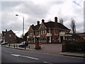
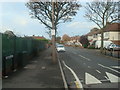
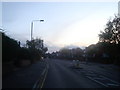
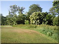
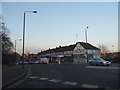

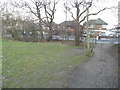
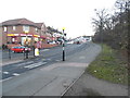
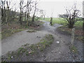
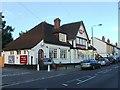
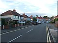
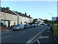
49 photos from this area
Area Information
Key information about the DA7 5AQ including its size, population, and administrative classification.
- Area Type
- Postcode
- Area Size
- 1.3 hectares
- Population
- 1658
- Population Density
- 5630 people/km²
House Prices in DA7 5AQ
25
Properties
£307,368
Average Sold Price
£60,000
Lowest Price
£585,000
Highest Price
Showing 25 properties
| Address | Type | Beds | Baths | Last Sale Price | Last Sale Date | |
|---|---|---|---|---|---|---|
| 196 Long Lane, Bexleyheath, DA7 5AQ | Semi-detached | 3 | 1 | £505,000 | Jan 2025 | |
| 200 Long Lane, Bexleyheath, DA7 5AQ | Semi-detached | 3 | 1 | £510,000 | Jan 2025 | |
| 190 Long Lane, Bexleyheath, DA7 5AQ | Detached | - | - | £241,000 | Aug 2021 | |
| 186A Long Lane, Bexleyheath, DA7 5AQ | Semi-detached | 2 | 1 | £410,000 | Sep 2020 | |
| 186 Long Lane, Bexleyheath, DA7 5AQ | Semi-detached | 3 | 2 | £465,000 | Feb 2020 | |
| 198 Long Lane, Bexleyheath, DA7 5AQ | Semi-detached | 3 | 1 | £430,000 | Oct 2017 | |
| 170 Long Lane, Bexleyheath, DA7 5AQ | Bungalow | 2 | 1 | £390,000 | Sep 2017 | |
| 174 Long Lane, Bexleyheath, DA7 5AQ | Semi-detached | 4 | 2 | £585,000 | Jul 2017 | |
| 172 Long Lane, Bexleyheath, DA7 5AQ | Semi-detached | 2 | - | £415,000 | Mar 2017 | |
| 184 Long Lane, Bexleyheath, DA7 5AQ | Semi-detached | 4 | 1 | £400,000 | Feb 2015 |
Page 1 of 3
Energy Efficiency in DA7 5AQ
Amenities
Schools
| Rank | School | Type | Entry gender | Ages |
|---|
Explore more schools in this area
Go to Schools tabDemographics
Household Size
Family (3-5 people)
most common
Accommodation Type
Houses
most common
Tenure
80
majority
Ethnic Group
White
most common
Religion
N/A
most common
Household Composition
N/A
most common
Age
47
median
Adults (30-64 years)
most common
Household Deprivation
N/A
with no deprivation
NS-SEC
36
in Lower managerial occupations
Explore more demographic insights in this area
Go to Demographics tabPlanning
Planning Constraints
- Flood RiskPremium
- Ramsar Wetland SitesPremium
- Area of Outstanding Natural BeautyPremium
- Protected Nature ReservePremium
- Protected WoodlandPremium