Area Overview for DA7 4RA
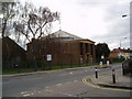
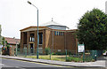
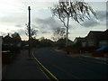
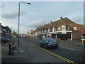
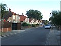
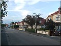
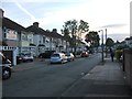
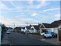
Photos of DA7 4RA
Area Information
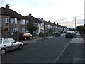
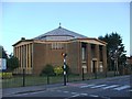
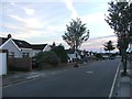
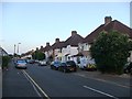
DA7 4RA is a small residential cluster in the London Borough of Bexley, situated near the western edge of Bexleyheath, bordering Welling. With a population of 1,568, it is a low-density area defined more by its proximity to Watling Street (A207) than by distinct boundaries. The area merges seamlessly with Bexleyheath and Welling, forming a quiet, semi-rural locality at the edge of London. Its name originates from “crooked logs” of pollarded trees used in shipbuilding as early as 1609, a legacy reflected in the historic Old Crook Log pub, mentioned in Charles Dickens’s *A Tale of Two Cities*. Daily life here is shaped by its historical roots and practical connectivity. Residents benefit from nearby rail links to central London, while the area’s low population density offers a sense of space. Though not a standalone town, DA7 4RA’s character is defined by its mix of traditional housing, proximity to green spaces, and access to modern amenities within a short reach.
- Area Type
- Postcode
- Area Size
- Not available
- Population
- Not available
- Population Density
- Not available
DA7 4RA is a predominantly owner-occupied area, with 85% of homes owned by residents rather than rented. The accommodation type is primarily houses, which is unusual for London’s typically mixed housing stock. This suggests a focus on family homes, likely with gardens or larger living spaces, catering to those seeking space and stability. The area’s small size means the housing stock is limited, so buyers may need to consider nearby postcodes such as Bexleyheath or Welling for more options. The high home ownership rate and house-centric market indicate a community that values long-term investment over rental flexibility. For buyers, this means properties here are likely to be in high demand, but competition may be fierce due to the area’s limited supply. The proximity to rail links and schools also makes it attractive for families seeking a balance between suburban living and urban access.
House Prices in DA7 4RA
No properties found in this postcode.
Energy Efficiency in DA7 4RA
Living in DA7 4RA offers access to a range of amenities within practical reach. Retail options include Co-op Pickford, Sainsburys Avenue, and Asda Bexleyheath, providing everyday shopping convenience. The area’s rail stations connect to broader networks, while ferry services to Woolwich Arsenal Pier and the nearby London City Airport add to its connectivity. Though the data does not specify parks or leisure facilities, the area’s historical roots and proximity to Bexleyheath suggest nearby green spaces. The mix of retail, transport, and travel options creates a practical lifestyle, balancing suburban tranquillity with urban accessibility. The presence of multiple rail and ferry options also supports a dynamic, mobile lifestyle, appealing to those who value convenience without sacrificing the area’s quieter character.
Amenities
Schools
The nearest schools to DA7 4RA are Brampton Primary School and Brampton Primary Academy, both offering primary education. Brampton Primary Academy has an Ofsted rating of “good”, reflecting its quality of teaching and facilities. The presence of two primary schools provides families with options, though secondary education would require travel to nearby areas such as Bexleyheath or Welling. The schools’ proximity to residential areas suggests a focus on local community schooling, which can be beneficial for parents seeking convenience. However, the data does not include information on secondary schools, so families with older children may need to consider commuting. The “good” rating at Brampton Primary Academy indicates a reliable educational foundation, though the lack of diversity in school types limits broader choices for parents.
| Rank | School | Type | Entry gender | Ages |
|---|
Explore more schools in this area
Go to Schools tabDemographics
The community in DA7 4RA is predominantly middle-aged, with a median age of 47 and the most common age range being adults aged 30–64. Home ownership is high, at 85%, indicating a stable, long-term resident base. The area is largely composed of houses rather than flats, reflecting a preference for family-oriented living. The predominant ethnic group is White, though specific diversity statistics are not provided. The age profile suggests a mature population, likely with established careers and families. The high home ownership rate implies lower rental activity, which can stabilise property values but may limit options for transient buyers. The absence of detailed deprivation data means the area’s socioeconomic challenges are not explicitly quantified, though the demographic profile suggests a relatively settled, middle-income community.
Household Size
Accommodation Type
Tenure
Ethnic Group
Religion
Household Composition
Age
Household Deprivation
NS-SEC
Explore more demographic insights in this area
Go to Demographics tabPlanning
Planning Constraints
- Flood RiskPremium
- Ramsar Wetland SitesPremium
- Area of Outstanding Natural BeautyPremium
- Protected Nature ReservePremium
- Protected WoodlandPremium