Area Overview for DA7 4QZ
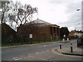
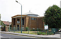
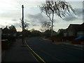
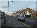
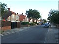
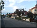
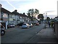
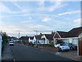
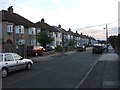
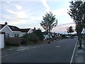
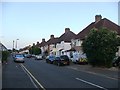
Photos of DA7 4QZ

Area Information
DA7 4QZ lies in the London Borough of Bexley, nestled along Watling Street (A207) at the western edge of Bexleyheath, bordering Welling. This small residential cluster, part of Crook Log Ward, has a population of 1,568, reflecting its compact, tight-knit character. Historically, the area is tied to the Crook Log public house, a landmark dating back to 1738 and referenced in Charles Dickens’ *A Tale of Two Cities*. The locality blends suburban calm with proximity to London’s infrastructure, 10.9 miles from Charing Cross. Daily life here is shaped by its mix of traditional housing and modern amenities, with a strong focus on local history and community. Residents benefit from proximity to multiple rail stations, retail hubs, and schools, while the area’s low flood risk and absence of protected natural sites suggest a practical, low-constraint environment. However, its small size means the immediate surroundings are key for broader lifestyle needs.
- Area Type
- Postcode
- Area Size
- Not available
- Population
- Not available
- Population Density
- Not available
DA7 4QZ is predominantly an owner-occupied area, with 85% of homes owned by residents rather than rented. The accommodation type is largely houses, which is typical of suburban Bexley. This suggests a housing stock that prioritises family-friendly, single-unit properties over flats or apartments. Given the area’s small size, the property market is limited to a few hundred homes, meaning buyers may need to consider nearby wards like Bexleyheath or Welling for more options. The high home ownership rate indicates long-term residency and investment in the area, which can stabilise property values. However, the lack of rental properties may make it less attractive for those seeking flexibility or lower entry costs.
House Prices in DA7 4QZ
No properties found in this postcode.
Energy Efficiency in DA7 4QZ
Residents of DA7 4QZ enjoy a range of amenities within practical reach. Retail options include Co-op Pickford, Sainsburys Avenue, and Asda Bexleyheath, offering everyday shopping needs. The area’s proximity to five rail stations, five metro stations, and ferry piers ensures easy access to transport networks, linking to London and beyond. While specific parks or leisure facilities are not listed, the area’s integration with Bexleyheath and Welling suggests nearby green spaces and recreational opportunities. The presence of London City Airport nearby adds to the area’s connectivity, though the focus on retail and transport highlights a pragmatic, service-oriented lifestyle. The mix of amenities supports both daily convenience and broader mobility.
Amenities
Schools
Residents of DA7 4QZ have access to two primary schools: Brampton Primary School and Brampton Primary Academy. Both cater to younger children, with the latter holding a ‘good’ Ofsted rating, indicating reliable standards of education. The presence of two primary schools within the area offers families flexibility and reduces travel time for younger children. However, no secondary schools are listed in the data, meaning older students may need to attend schools in adjacent areas like Bexleyheath or Welling. The focus on primary education suggests the area is well-served for early years but may require additional planning for secondary schooling.
| Rank | School | Type | Entry gender | Ages |
|---|
Explore more schools in this area
Go to Schools tabDemographics
DA7 4QZ has a median age of 47, with the majority of residents aged 30–64, indicating a mature, stable population. Home ownership is high at 85%, with houses the predominant accommodation type, suggesting a mix of long-term residents and families. The predominant ethnic group is White, reflecting the area’s historical and demographic continuity. This age profile aligns with a community that values established living, with fewer young families compared to other parts of Bexley. The absence of specific deprivation data means the quality of life is inferred through amenities and infrastructure, which appear robust. The demographic profile suggests a focus on comfort, stability, and proximity to services rather than rapid growth or change.
Household Size
Accommodation Type
Tenure
Ethnic Group
Religion
Household Composition
Age
Household Deprivation
NS-SEC
Explore more demographic insights in this area
Go to Demographics tabPlanning
Planning Constraints
- Flood RiskPremium
- Ramsar Wetland SitesPremium
- Area of Outstanding Natural BeautyPremium
- Protected Nature ReservePremium
- Protected WoodlandPremium