Area Overview for DA7 4PH
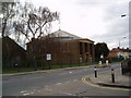
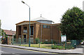
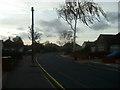
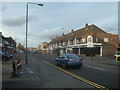
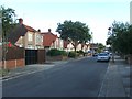
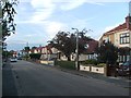
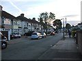
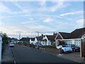
Photos of DA7 4PH
Area Information
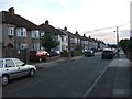
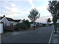
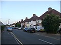
DA7 4PH is a small, tightly knit residential cluster in the London Borough of Bexley, situated near Watling Street (A207) at the western edge of Bexleyheath. The area covers 6,749 square metres and is home to 1,658 residents, making it one of the more densely populated pockets in the borough. With a population density of 245,656 people per square kilometre, the community feels compact and closely connected. Historically, the area is tied to the Crook Log locality, a name derived from 17th-century shipbuilding practices. Though it merges seamlessly with Bexleyheath and Welling, DA7 4PH retains a distinct identity, shaped by its proximity to key transport routes like the A207 and its links to Bexleyheath’s tram services. Daily life here is defined by a mix of local amenities, strong digital connectivity, and a low crime rate, appealing to those seeking a balance between urban convenience and a sense of community.
- Area Type
- Postcode
- Area Size
- 6749 m²
- Population
- 1658
- Population Density
- 5630 people/km²
DA7 4PH is predominantly an owner-occupied area, with 80% of homes owned by residents rather than rented. The accommodation type is primarily houses, which is unusual for a postcode of this size but reflects the area’s suburban character. This suggests a market focused on family homes rather than apartments or flats. Given the small size of the area, property availability is limited, and buyers should consider nearby zones like Bexleyheath and Welling for broader options. The high home ownership rate indicates long-term residency, which may influence property values and demand. For buyers, the area’s compact nature means proximity to amenities and transport is a key selling point, though the limited housing stock could make competition for properties more intense.
House Prices in DA7 4PH
No properties found in this postcode.
Energy Efficiency in DA7 4PH
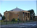
DA7 4PH offers a range of amenities within practical reach, including five retail outlets such as Co-op Long, Co-op Pickford, and Sainsburys Avenue. These shops provide everyday convenience for residents. The area is also served by five rail stations, three ferry piers, and a metro station, ensuring easy access to public transport. Nearby leisure options include the historic Crook Log public house, a landmark tied to the area’s heritage. The presence of London City Airport adds to the area’s connectivity, though it does not directly serve local residents. The mix of retail, transport, and historical sites creates a lifestyle that balances practicality with a touch of local character, making daily life in DA7 4PH both functional and rooted in its surroundings.
Amenities
Schools
The nearest school to DA7 4PH is St Thomas More Catholic Primary School, which serves the primary education needs of the area. While the data does not provide an Ofsted rating, the presence of a single primary school suggests that families may need to look beyond the immediate postcode for secondary education options. The school’s religious affiliation indicates it is part of a Catholic educational network, which may appeal to specific communities. Given the area’s focus on houses and family-oriented living, the school likely plays a central role in the local community. However, the absence of additional schools or educational facilities within the postcode highlights the need for residents to access nearby areas for broader schooling opportunities.
| Rank | School | Type | Entry gender | Ages |
|---|
Explore more schools in this area
Go to Schools tabDemographics
The population of DA7 4PH has a median age of 47, with the majority of residents falling within the 30–64 age range. This suggests a community skewed towards middle-aged adults, likely including families and professionals. Home ownership is high at 80%, indicating a stable, long-term resident base. The predominant accommodation type is houses, which aligns with the area’s residential character. The predominant ethnic group is White, reflecting broader demographic trends in Bexley. While specific data on deprivation is not provided, the high home ownership rate and low crime score (81/100) suggest a relatively affluent and secure environment. The absence of detailed diversity metrics means the community’s cultural composition remains less defined in the data, though it is clear that the area is not heavily influenced by transient or rental populations.
Household Size
Accommodation Type
Tenure
Ethnic Group
Religion
Household Composition
Age
Household Deprivation
NS-SEC
Explore more demographic insights in this area
Go to Demographics tabPlanning
Planning Constraints
- Flood RiskPremium
- Ramsar Wetland SitesPremium
- Area of Outstanding Natural BeautyPremium
- Protected Nature ReservePremium
- Protected WoodlandPremium