Area Overview for DA7 4HH
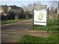
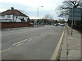
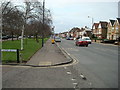
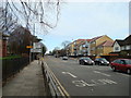
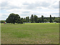
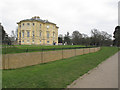
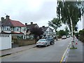
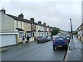
Photos of DA7 4HH


Area Information
DA7 4HH is a small, tightly knit residential cluster in the London Borough of Bexley, situated near Watling Street (A207) at the western edge of Bexleyheath. With a population of 1,695 spread across 1.3 hectares, the area is densely populated, with 125,688 people per square kilometre. This compact postcode merges seamlessly with Bexleyheath and Welling, forming a locality rather than a distinct settlement. The area’s history is rooted in its 18th-century origins, with the Crook Log public house—mentioned by Charles Dickens—serving as a focal point. Daily life here is shaped by its proximity to transport networks, including Bexleyheath Station and Welling Station, and its blend of historic character with modern convenience. Residents benefit from a mix of retail, educational, and transport options within walking distance, while the area’s low crime risk and excellent broadband connectivity support both home and work life. Living in DA7 4HH offers a compact, community-oriented environment with easy access to London’s broader infrastructure.
- Area Type
- Postcode
- Area Size
- 1.3 hectares
- Population
- 1695
- Population Density
- 6137 people/km²
DA7 4HH is a predominantly owner-occupied area, with 84% of homes owned by residents rather than rented. The accommodation type is exclusively houses, which is unusual for modern urban areas and suggests a focus on traditional, family-sized properties. Given the area’s small size—just 1.3 hectares—this housing stock is limited, making it a niche market for buyers seeking single-family homes. The high home ownership rate indicates strong community attachment and long-term residency, which can be appealing to those prioritising stability. However, the compact nature of the area means that property availability is constrained, and buyers should consider proximity to nearby towns like Bexleyheath or Welling for more options. The mix of historic and modern housing reflects the area’s evolution from heathland to a residential hub.
House Prices in DA7 4HH
No properties found in this postcode.
Energy Efficiency in DA7 4HH
DA7 4HH offers a range of amenities within practical reach, enhancing daily life for residents. Retail options include Asda Bexleyheath, Sainsburys Avenue, and Co-op Pickford, providing essential shopping. Transport links are extensive, with rail stations like Bexleyheath and Welling offering easy access to London. Ferry services such as Woolwich Arsenal Pier and Woolwich Ferry North Pier connect to nearby areas, while the proximity to London City Airport benefits those needing air travel. The area’s compact size means amenities are concentrated, reducing travel time. Though specific parks or leisure facilities are not listed, the nearby Bexleyheath and Welling areas likely host green spaces and community hubs. This blend of retail, transport, and connectivity supports a convenient, active lifestyle with minimal need for long commutes.
Amenities
Schools
Near DA7 4HH are several schools catering to different educational needs. Foster’s Primary School, a primary school with a ‘good’ Ofsted rating, provides early education for local children. Westbrooke School and Park View Academy are special needs schools, both with a ‘good’ rating for the latter, indicating support for students with specific learning requirements. Aspire Academy is another special needs school. The presence of both mainstream and special needs schools offers families flexibility, though the absence of secondary schools in the immediate area may require commuting. This mix reflects the area’s role as part of a larger educational network, with nearby towns likely hosting additional schools. Families should consider travel times for secondary education, as none are listed within DA7 4HH itself.
| Rank | School | Type | Entry gender | Ages |
|---|
Explore more schools in this area
Go to Schools tabDemographics
The population of DA7 4HH is predominantly adults aged 30–64, with a median age of 47. This suggests a mature, stable community with a strong presence of working-age residents. Home ownership is high, at 84%, and the area is characterised by houses rather than flats, indicating a focus on family-friendly, long-term living. The predominant ethnic group is White, reflecting the broader demographic trends in Bexley. The high home ownership rate and age profile suggest a community with established roots, where residents are likely to remain for extended periods. This stability contributes to a cohesive neighbourhood dynamic. However, the data does not provide specific information on deprivation levels, so it is not possible to assess socioeconomic diversity or access to services beyond what is explicitly stated.
Household Size
Accommodation Type
Tenure
Ethnic Group
Religion
Household Composition
Age
Household Deprivation
NS-SEC
Explore more demographic insights in this area
Go to Demographics tabPlanning
Planning Constraints
- Flood RiskPremium
- Ramsar Wetland SitesPremium
- Area of Outstanding Natural BeautyPremium
- Protected Nature ReservePremium
- Protected WoodlandPremium