Area Overview for DA7 4ER
Photos of DA7 4ER
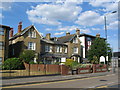

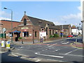
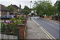
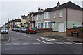
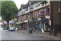
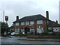
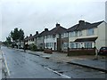
100 photos from this area
Area Information
Key information about the DA7 4ER including its size, population, and administrative classification.
- Area Type
- Postcode
- Area Size
- 9339 m²
- Population
- 1628
- Population Density
- 6869 people/km²
House Prices in DA7 4ER
26
Properties
£367,179
Average Sold Price
£98,000
Lowest Price
£795,000
Highest Price
Showing 26 properties
| Address | Type | Beds | Baths | Last Sale Price | Last Sale Date | |
|---|---|---|---|---|---|---|
| 30A Avenue Road, Bexleyheath, DA7 4ER | Detached | 2 | 2 | £400,000 | Oct 2025 | |
| 32 Avenue Road, Bexleyheath, DA7 4ER | Semi-detached | 3 | 2 | £465,000 | Jun 2023 | |
| 36 Avenue Road, Bexleyheath, DA7 4ER | Detached | 3 | 1 | £440,000 | Apr 2021 | |
| 12A Avenue Road, Bexleyheath, DA7 4ER | Bungalow | - | - | £538,000 | Mar 2021 | |
| 18 Avenue Road, Bexleyheath, DA7 4ER | Detached | 5 | 2 | £795,000 | Feb 2021 | |
| 12 Avenue Road, Bexleyheath, DA7 4ER | Bungalow | - | - | £404,000 | Jan 2018 | |
| 14 Avenue Road, Bexleyheath, DA7 4ER | house | - | - | £442,000 | Aug 2012 | |
| 34 Avenue Road, Bexleyheath, DA7 4ER | house | - | - | £150,000 | May 2010 | |
| 20 Avenue Road, Bexleyheath, DA7 4ER | house | - | - | £354,995 | Nov 2009 | |
| 30 Avenue Road, Bexleyheath, DA7 4ER | Flat | - | - | £249,995 | Mar 2007 |
Page 1 of 3
Energy Efficiency in DA7 4ER
Amenities
Schools
| Rank | School | Type | Entry gender | Ages |
|---|
Explore more schools in this area
Go to Schools tabDemographics
Household Size
Family (3-5 people)
most common
Accommodation Type
Houses
most common
Tenure
73
majority
Ethnic Group
White
most common
Religion
N/A
most common
Household Composition
N/A
most common
Age
47
median
Adults (30-64 years)
most common
Household Deprivation
N/A
with no deprivation
NS-SEC
40
in Lower managerial occupations
Explore more demographic insights in this area
Go to Demographics tabPlanning
Planning Constraints
- Flood RiskPremium
- Ramsar Wetland SitesPremium
- Area of Outstanding Natural BeautyPremium
- Protected Nature ReservePremium
- Protected WoodlandPremium