Area Overview for DA6 8EL
Photos of DA6 8EL
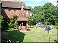
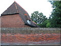
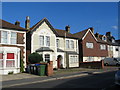
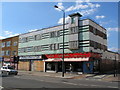
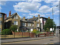

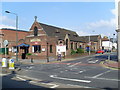
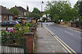
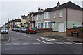
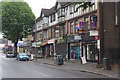
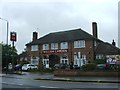
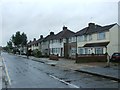
100 photos from this area
Area Information
Key information about the DA6 8EL including its size, population, and administrative classification.
- Area Type
- Postcode
- Area Size
- 9799 m²
- Population
- 1700
- Population Density
- 3845 people/km²
House Prices in DA6 8EL
31
Properties
£297,533
Average Sold Price
£104,995
Lowest Price
£550,000
Highest Price
Showing 31 properties
| Address | Type | Beds | Baths | Last Sale Price | Last Sale Date | |
|---|---|---|---|---|---|---|
| 43 Brunswick Road, Bexleyheath, DA6 8EL | Flat | - | - | £160,000 | Mar 2023 | |
| 3 Brunswick Road, Bexleyheath, DA6 8EL | Semi-detached | 3 | 1 | £450,000 | Jul 2022 | |
| 51 Brunswick Road, Bexleyheath, DA6 8EL | Maisonette | 2 | 1 | £325,000 | Feb 2022 | |
| 13 Brunswick Road, Bexleyheath, DA6 8EL | house | - | - | £550,000 | Mar 2021 | |
| 7 Brunswick Road, Bexleyheath, DA6 8EL | Semi-detached | 3 | 1 | £444,490 | Feb 2021 | |
| 15 Brunswick Road, Bexleyheath, DA6 8EL | Semi-detached | 4 | 1 | £545,000 | Dec 2020 | |
| 55 Brunswick Road, Bexleyheath, DA6 8EL | Semi-detached | 3 | 2 | £500,000 | Dec 2019 | |
| 55A Brunswick Road, Bexleyheath, DA6 8EL | house | - | - | £515,000 | Nov 2019 | |
| 49 Brunswick Road, Bexleyheath, DA6 8EL | Flat | - | - | £255,200 | Apr 2018 | |
| 31 Brunswick Road, Bexleyheath, DA6 8EL | Maisonette | 2 | 1 | £267,000 | Jul 2016 |
Page 1 of 4
Energy Efficiency in DA6 8EL
Amenities
Schools
| Rank | School | Type | Entry gender | Ages |
|---|
Explore more schools in this area
Go to Schools tabDemographics
Household Size
Family (3-5 people)
most common
Accommodation Type
Houses
most common
Tenure
71
majority
Ethnic Group
White
most common
Religion
N/A
most common
Household Composition
N/A
most common
Age
47
median
Adults (30-64 years)
most common
Household Deprivation
N/A
with no deprivation
NS-SEC
41
in Lower managerial occupations
Explore more demographic insights in this area
Go to Demographics tabPlanning
Planning Constraints
- Flood RiskPremium
- Ramsar Wetland SitesPremium
- Area of Outstanding Natural BeautyPremium
- Protected Nature ReservePremium
- Protected WoodlandPremium