Area Overview for DA6 8DS
Photos of DA6 8DS
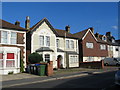
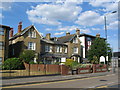

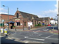
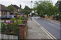
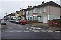
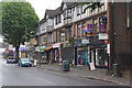
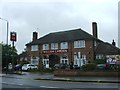
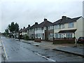
100 photos from this area
Area Information
Key information about the DA6 8DS including its size, population, and administrative classification.
- Area Type
- Postcode
- Area Size
- 5289 m²
- Population
- Not available
- Population Density
- Not available
House Prices in DA6 8DS
11
Properties
£391,188
Average Sold Price
£67,500
Lowest Price
£750,000
Highest Price
Showing 11 properties
| Address | Type | Beds | Baths | Last Sale Price | Last Sale Date | |
|---|---|---|---|---|---|---|
| 12 Devonshire Road, Bexleyheath, DA6 8DS | Semi-detached | 3 | 2 | £424,000 | Mar 2025 | |
| 6 Devonshire Road, Bexleyheath, DA6 8DS | house | - | - | £750,000 | Oct 2021 | |
| 16 Devonshire Road, Bexleyheath, DA6 8DS | house | - | - | £520,000 | Jan 2021 | |
| 18 Devonshire Road, Bexleyheath, DA6 8DS | Detached | 4 | - | £560,000 | May 2017 | |
| 8 Devonshire Road, Bexleyheath, DA6 8DS | house | - | - | £335,000 | Jan 2012 | |
| 4 Devonshire Road, Bexleyheath, DA6 8DS | Semi-detached | 3 | - | £315,000 | Dec 2007 | |
| 10 Devonshire Road, Bexleyheath, DA6 8DS | Semi-detached | - | - | £158,000 | Aug 2001 | |
| 2 Devonshire Road, Bexleyheath, DA6 8DS | Flat | 2 | 2 | £67,500 | Mar 1995 | |
| First Floor, Westhill House, Devonshire Road, Bexleyheath, DA6 8DS | retail_financial | - | - | - | - | |
| 14 Devonshire Road, Bexleyheath, DA6 8DS | house | - | - | - | - |
Page 1 of 2
Energy Efficiency in DA6 8DS
Amenities
Schools
| Rank | School | Type | Entry gender | Ages |
|---|
Explore more schools in this area
Go to Schools tabDemographics
Household Size
Family (3-5 people)
most common
Accommodation Type
Houses
most common
Tenure
63
majority
Ethnic Group
White
most common
Religion
N/A
most common
Household Composition
N/A
most common
Age
47
median
Adults (30-64 years)
most common
Household Deprivation
N/A
with no deprivation
NS-SEC
35
in Lower managerial occupations
Explore more demographic insights in this area
Go to Demographics tabPlanning
Planning Constraints
- Flood RiskPremium
- Ramsar Wetland SitesPremium
- Area of Outstanding Natural BeautyPremium
- Protected Nature ReservePremium
- Protected WoodlandPremium