Area Overview for DA5 3AP
Photos of DA5 3AP
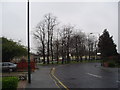
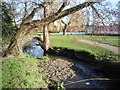
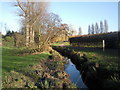
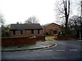
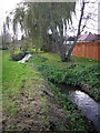
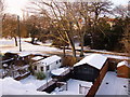
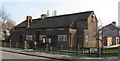
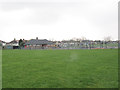
70 photos from this area
Area Information
Key information about the DA5 3AP including its size, population, and administrative classification.
- Area Type
- Postcode
- Area Size
- 6697 m²
- Population
- 1505
- Population Density
- 5373 people/km²
House Prices in DA5 3AP
26
Properties
£248,750
Average Sold Price
£63,000
Lowest Price
£530,000
Highest Price
Showing 26 properties
| Address | Type | Beds | Baths | Last Sale Price | Last Sale Date | |
|---|---|---|---|---|---|---|
| 27 Montpelier Avenue, Bexley, DA5 3AP | Terraced | 2 | 2 | £510,000 | Mar 2023 | |
| 25 Montpelier Avenue, Bexley, DA5 3AP | Flat | 2 | 1 | £323,000 | Nov 2022 | |
| 11A Montpelier Avenue, Bexley, DA5 3AP | Flat | - | - | £175,000 | Sep 2021 | |
| 33 Montpelier Avenue, Bexley, DA5 3AP | Terraced | 3 | 3 | £530,000 | Jun 2020 | |
| 35 Montpelier Avenue, Bexley, DA5 3AP | house | 3 | 1 | £382,500 | May 2019 | |
| 23A Montpelier Avenue, Bexley, DA5 3AP | Flat | 2 | 1 | £175,000 | Apr 2019 | |
| 37 Montpelier Avenue, Bexley, DA5 3AP | Terraced | 3 | 1 | £420,000 | Jul 2018 | |
| 13A Montpelier Avenue, Bexley, DA5 3AP | Maisonette | - | - | £130,000 | Dec 2017 | |
| 7A Montpelier Avenue, Bexley, DA5 3AP | Flat | - | - | £325,000 | Feb 2017 | |
| 31 Montpelier Avenue, Bexley, DA5 3AP | Terraced | 2 | - | £290,000 | Nov 2014 |
Page 1 of 3
Energy Efficiency in DA5 3AP
Amenities
Schools
| Rank | School | Type | Entry gender | Ages |
|---|
Explore more schools in this area
Go to Schools tabDemographics
Household Size
Family (3-5 people)
most common
Accommodation Type
Houses
most common
Tenure
89
majority
Ethnic Group
White
most common
Religion
N/A
most common
Household Composition
N/A
most common
Age
47
median
Adults (30-64 years)
most common
Household Deprivation
N/A
with no deprivation
NS-SEC
39
in Lower managerial occupations
Explore more demographic insights in this area
Go to Demographics tabPlanning
Planning Constraints
- Flood RiskPremium
- Ramsar Wetland SitesPremium
- Area of Outstanding Natural BeautyPremium
- Protected Nature ReservePremium
- Protected WoodlandPremium