Area Overview for DA5 2DQ
Photos of DA5 2DQ
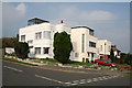
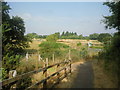
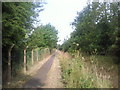
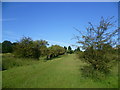
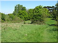
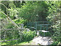
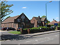
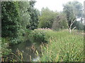
49 photos from this area
Area Information
Key information about the DA5 2DQ including its size, population, and administrative classification.
- Area Type
- Postcode
- Area Size
- 2.6 hectares
- Population
- 1642
- Population Density
- 1190 people/km²
House Prices in DA5 2DQ
30
Properties
£581,342
Average Sold Price
£126,000
Lowest Price
£975,000
Highest Price
Showing 30 properties
| Address | Type | Beds | Baths | Last Sale Price | Last Sale Date | |
|---|---|---|---|---|---|---|
| 30 Wansunt Road, Bexley, DA5 2DQ | Semi-detached | 3 | 1 | £785,000 | Dec 2024 | |
| 38 Wansunt Road, Bexley, DA5 2DQ | Detached | 4 | 1 | £890,000 | Nov 2023 | |
| 25 Wansunt Road, Bexley, DA5 2DQ | house | - | - | £975,000 | Sep 2019 | |
| 18 Wansunt Road, Bexley, DA5 2DQ | Semi-detached | 3 | 1 | £845,000 | Aug 2018 | |
| 19 Wansunt Road, Bexley, DA5 2DQ | house | - | - | £815,000 | Nov 2017 | |
| 8 Wansunt Road, Bexley, DA5 2DQ | house | - | - | £875,000 | Aug 2015 | |
| 10 Wansunt Road, Bexley, DA5 2DQ | Detached | 4 | 2 | £725,000 | Jun 2015 | |
| 29 Wansunt Road, Bexley, DA5 2DQ | Detached | 4 | 3 | £850,000 | Dec 2014 | |
| 26 Wansunt Road, Bexley, DA5 2DQ | Semi-detached | 3 | 1 | £430,000 | Feb 2014 | |
| 12 Wansunt Road, Bexley, DA5 2DQ | Detached | 5 | - | £750,000 | Aug 2013 |
Page 1 of 3
Energy Efficiency in DA5 2DQ
Amenities
Schools
| Rank | School | Type | Entry gender | Ages |
|---|
Explore more schools in this area
Go to Schools tabDemographics
Household Size
Family (3-5 people)
most common
Accommodation Type
Houses
most common
Tenure
90
majority
Ethnic Group
White
most common
Religion
N/A
most common
Household Composition
N/A
most common
Age
47
median
Adults (30-64 years)
most common
Household Deprivation
N/A
with no deprivation
NS-SEC
45
in Lower managerial occupations
Explore more demographic insights in this area
Go to Demographics tabPlanning
Planning Constraints
- Flood RiskPremium
- Ramsar Wetland SitesPremium
- Area of Outstanding Natural BeautyPremium
- Protected Nature ReservePremium
- Protected WoodlandPremium