Area Overview for DA5 2DP
Photos of DA5 2DP

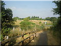


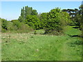

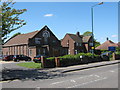


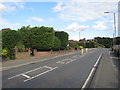
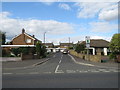
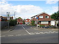
49 photos from this area
Area Information
Key information about the DA5 2DP including its size, population, and administrative classification.
- Area Type
- Postcode
- Area Size
- 9536 m²
- Population
- 1642
- Population Density
- 1190 people/km²
House Prices in DA5 2DP
11
Properties
£528,167
Average Sold Price
£275,000
Lowest Price
£767,500
Highest Price
Showing 11 properties
| Address | Type | Beds | Baths | Last Sale Price | Last Sale Date | |
|---|---|---|---|---|---|---|
| 18 Heath Road, Bexley, DA5 2DP | Detached | 4 | 1 | £767,500 | Oct 2023 | |
| 15A Heath Road, Bexley, DA5 2DP | house | 2 | 1 | £445,000 | Dec 2019 | |
| 14 Heath Road, Bexley, DA5 2DP | Detached | 2 | 2 | £446,000 | Dec 2017 | |
| 20 Heath Road, Bexley, DA5 2DP | house | 5 | - | £535,000 | Oct 2013 | |
| 16 Heath Road, Bexley, DA5 2DP | Detached | 3 | 2 | £465,000 | Jun 2013 | |
| 22 Heath Road, Bexley, DA5 2DP | house | 5 | - | £610,000 | Nov 2012 | |
| 17 Heath Road, Bexley, DA5 2DP | Semi-detached | 4 | 2 | £680,000 | May 2008 | |
| 24 Heath Road, Bexley, DA5 2DP | Detached | - | - | £530,000 | Jan 2006 | |
| 15 Heath Road, Bexley, DA5 2DP | Bungalow | 2 | 1 | £275,000 | Apr 2004 | |
| 21 Heath Road, Bexley, DA5 2DP | Semi-detached | 4 | 2 | - | - |
Page 1 of 2
Energy Efficiency in DA5 2DP
Amenities
Schools
| Rank | School | Type | Entry gender | Ages |
|---|
Explore more schools in this area
Go to Schools tabDemographics
Household Size
Family (3-5 people)
most common
Accommodation Type
Houses
most common
Tenure
90
majority
Ethnic Group
White
most common
Religion
N/A
most common
Household Composition
N/A
most common
Age
47
median
Adults (30-64 years)
most common
Household Deprivation
N/A
with no deprivation
NS-SEC
45
in Lower managerial occupations
Explore more demographic insights in this area
Go to Demographics tabPlanning
Planning Constraints
- Flood RiskPremium
- Ramsar Wetland SitesPremium
- Area of Outstanding Natural BeautyPremium
- Protected Nature ReservePremium
- Protected WoodlandPremium