Area Overview for DA5 1RL
Photos of DA5 1RL
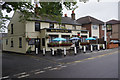
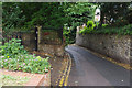
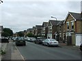
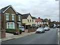
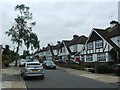
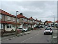
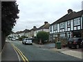
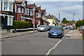
42 photos from this area
Area Information
Key information about the DA5 1RL including its size, population, and administrative classification.
- Area Type
- Postcode
- Area Size
- 1.1 hectares
- Population
- 1723
- Population Density
- 5170 people/km²
House Prices in DA5 1RL
21
Properties
£440,125
Average Sold Price
£165,000
Lowest Price
£717,000
Highest Price
Showing 21 properties
| Address | Type | Beds | Baths | Last Sale Price | Last Sale Date | |
|---|---|---|---|---|---|---|
| 13 Hartlands Close, Bexley, DA5 1RL | Detached | 4 | 2 | £675,000 | Nov 2023 | |
| 17 Hartlands Close, Bexley, DA5 1RL | Detached | 4 | 2 | £710,000 | Sep 2023 | |
| 2 Hartlands Close, Bexley, DA5 1RL | house | - | - | £717,000 | Mar 2022 | |
| 19 Hartlands Close, Bexley, DA5 1RL | Detached | 4 | 1 | £575,000 | Oct 2020 | |
| 3 Hartlands Close, Bexley, DA5 1RL | Detached | 4 | 2 | £515,000 | Jul 2015 | |
| 10 Hartlands Close, Bexley, DA5 1RL | Detached | 4 | 2 | £372,500 | Mar 2014 | |
| 16 Hartlands Close, Bexley, DA5 1RL | Detached | - | - | £360,000 | Jul 2009 | |
| 11 Hartlands Close, Bexley, DA5 1RL | Detached | 5 | 2 | £405,000 | May 2007 | |
| 1 Hartlands Close, Bexley, DA5 1RL | Detached | - | - | £340,000 | Dec 2002 | |
| 18 Hartlands Close, Bexley, DA5 1RL | Detached | - | - | £237,000 | Jun 2001 |
Page 1 of 3
Energy Efficiency in DA5 1RL
Amenities
Schools
| Rank | School | Type | Entry gender | Ages |
|---|
Explore more schools in this area
Go to Schools tabDemographics
Household Size
Family (3-5 people)
most common
Accommodation Type
Houses
most common
Tenure
93
majority
Ethnic Group
White
most common
Religion
N/A
most common
Household Composition
N/A
most common
Age
47
median
Adults (30-64 years)
most common
Household Deprivation
N/A
with no deprivation
NS-SEC
41
in Lower managerial occupations
Explore more demographic insights in this area
Go to Demographics tabPlanning
Planning Constraints
- Flood RiskPremium
- Ramsar Wetland SitesPremium
- Area of Outstanding Natural BeautyPremium
- Protected Nature ReservePremium
- Protected WoodlandPremium