Area Overview for DA5 1LW
Photos of DA5 1LW

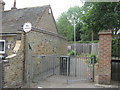
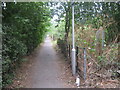
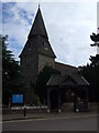
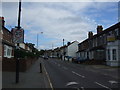
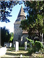
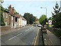


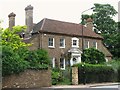

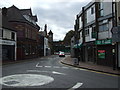
100 photos from this area
Area Information
Key information about the DA5 1LW including its size, population, and administrative classification.
- Area Type
- Postcode
- Area Size
- 14.9 hectares
- Population
- 1959
- Population Density
- 1976 people/km²
House Prices in DA5 1LW
43
Properties
£343,545
Average Sold Price
£104,000
Lowest Price
£650,000
Highest Price
Showing 43 properties
| Address | Type | Beds | Baths | Last Sale Price | Last Sale Date | |
|---|---|---|---|---|---|---|
| 91 Bourne Road, Bexley, DA5 1LW | Terraced | 2 | 1 | £450,000 | Jun 2025 | |
| 25 Bourne Road, Bexley, DA5 1LW | Terraced | 3 | 1 | £475,000 | Apr 2024 | |
| 77 Bourne Road, Bexley, DA5 1LW | Terraced | 3 | 2 | £543,000 | May 2022 | |
| 31 Bourne Road, Bexley, DA5 1LW | house | - | - | £435,000 | Dec 2021 | |
| 83 Bourne Road, Bexley, DA5 1LW | Detached | 3 | 1 | £400,000 | Sep 2021 | |
| 89 Bourne Road, Bexley, DA5 1LW | Terraced | 3 | 1 | £440,000 | Jun 2021 | |
| 85 Bourne Road, Bexley, DA5 1LW | house | - | - | £372,500 | Jun 2021 | |
| 41 Bourne Road, Bexley, DA5 1LW | house | - | - | £405,000 | Feb 2021 | |
| 33 Bourne Road, Bexley, DA5 1LW | Terraced | 3 | 2 | £455,000 | Nov 2020 | |
| 49 Bourne Road, Bexley, DA5 1LW | Terraced | 3 | 1 | £375,000 | Jul 2020 |
Page 1 of 5
Energy Efficiency in DA5 1LW
Amenities
Schools
| Rank | School | Type | Entry gender | Ages |
|---|
Explore more schools in this area
Go to Schools tabDemographics
Household Size
One person
most common
Accommodation Type
Houses
most common
Tenure
64
majority
Ethnic Group
White
most common
Religion
N/A
most common
Household Composition
N/A
most common
Age
47
median
Adults (30-64 years)
most common
Household Deprivation
N/A
with no deprivation
NS-SEC
46
in Lower managerial occupations
Explore more demographic insights in this area
Go to Demographics tabPlanning
Planning Constraints
- Flood RiskPremium
- Ramsar Wetland SitesPremium
- Area of Outstanding Natural BeautyPremium
- Protected Nature ReservePremium
- Protected WoodlandPremium