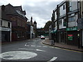
Area Overview for DA5 1HU
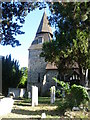
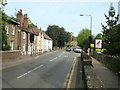
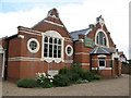
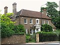
Photos of DA5 1HU


Area Information
DA5 1HU is a small, densely populated residential postcode in the London Borough of Bexley, covering just 446 square metres. Despite its compact size, it accommodates 1,562 residents, resulting in a population density of over 3.5 million people per square kilometre. This area is part of the St Mary’s & St James electoral ward, which elects two councillors to Bexley Council. The community here is predominantly composed of adults aged 30–64, with a median age of 47, reflecting a mature, settled population. Most residents own their homes, with 87% of properties in private ownership. The area’s character is defined by its proximity to multiple transport hubs, including rail and metro stations, and its accessibility to London City Airport. Daily life here balances suburban quiet with urban connectivity, offering residents a blend of convenience and low crime rates. The absence of major environmental constraints, such as protected woodlands or flood-prone zones, further underscores its practical appeal for homebuyers seeking stability and ease of access to London’s infrastructure.
- Area Type
- Postcode
- Area Size
- 446 m²
- Population
- 1562
- Population Density
- 3421 people/km²
DA5 1HU is a predominantly owner-occupied area, with 87% of properties in private hands, suggesting a stable housing market with limited rental demand. The accommodation type is exclusively houses, which is unusual for a small postcode but may indicate a mix of older, larger homes or semi-detached properties. This composition likely caters to families or individuals seeking more space than typical urban flats. The high home ownership rate implies strong community ties and long-term residency, though the area’s small size means buyers must consider nearby neighbourhoods for more options. The absence of planning constraints, such as protected nature reserves or flood zones, adds to its appeal, allowing for straightforward property transactions. However, the compact footprint may limit availability, requiring buyers to evaluate proximity to amenities and transport links.
House Prices in DA5 1HU
No properties found in this postcode.
Energy Efficiency in DA5 1HU
Living in DA5 1HU offers a mix of retail, transport, and leisure options within easy reach. Nearby, residents can access major retailers such as M&S Bexleyheath, Co-op Albany, and Sainsburys Bexleyheath, ensuring daily shopping needs are met. The area’s proximity to five rail stations, including Bexley and Bexleyheath, and five metro stops, like King George V., provides seamless access to London’s transport network. For those seeking alternative travel, three ferry piers—Woolwich Arsenal Pier and Barrier Gardens Pier—offer connections across the Thames. The presence of London City Airport nearby further enhances connectivity. These amenities create a convenient lifestyle, blending suburban comfort with urban accessibility. The variety of transport and retail choices ensures residents can balance work, leisure, and family needs without significant travel time.
Amenities
Schools
| Rank | School | Type | Entry gender | Ages |
|---|
Explore more schools in this area
Go to Schools tabDemographics
The population of DA5 1HU is predominantly adults aged 30–64, with a median age of 47, indicating a mature, established community. Over 87% of residents are homeowners, reflecting a strong preference for long-term property investment. The area is primarily composed of houses rather than flats, aligning with the demographic’s likely family-oriented needs. Ethnically, the population is largely White, though specific diversity metrics are not provided. The high home ownership rate and age profile suggest a community focused on stability and long-term residency. The area’s density—over 3.5 million people per square kilometre—raises questions about living space per household, though this is typical for urbanised postcode clusters. The low crime risk score of 93/100 further supports the appeal of DA5 1HU as a safe, family-friendly environment.
Household Size
Accommodation Type
Tenure
Ethnic Group
Religion
Household Composition
Age
Household Deprivation
NS-SEC
Explore more demographic insights in this area
Go to Demographics tabPlanning
Planning Constraints
- Flood RiskPremium
- Ramsar Wetland SitesPremium
- Area of Outstanding Natural BeautyPremium
- Protected Nature ReservePremium
- Protected WoodlandPremium