Area Overview for DA18 4ZX
Photos of DA18 4ZX


Area Information
Living in DA18 4ZX means being part of a small, tightly knit residential cluster in Thamesmead, a post-war new town in south-east London. Designed in the 1960s as part of a plan to house 60,000 people, the area features elevated housing, canals, and open spaces to counteract the risks of flooding and urban overcrowding. With a population of 1,713 and a density of 726 people per square kilometre, it is a compact community where proximity to the River Thames and nearby transport hubs defines daily life. The area’s history is steeped in both practicality and cultural significance: it was shaped by the 1953 North Sea Flood, became a filming location for *A Clockwork Orange*, and remains a symbol of post-war urban planning. Residents here benefit from a mix of modern infrastructure and historical context, with easy access to transport, retail, and green spaces. The blend of elevated housing and planned amenities creates a distinct character, though the area’s small size means it is best suited for those seeking a focused, community-oriented lifestyle.
- Area Type
- Postcode
- Area Size
- Not available
- Population
- 1713
- Population Density
- 726 people/km²
The property market in DA18 4ZX is characterised by a high proportion of rental properties, with only 30% of homes owned by residents. The accommodation type is almost exclusively flats, a legacy of the area’s 1960s planning, which prioritised high-density living to accommodate large numbers of people in a compact space. This makes DA18 4ZX a rental-focused area, with limited opportunities for owner-occupation. For buyers, the small size of the postcode area means that the immediate surroundings are key to finding available properties. The focus on flats suggests a market geared towards families or individuals seeking manageable, centrally located housing. However, the limited home ownership rate indicates that the area may not be ideal for those seeking long-term investment in property, as it is more suited to those prioritising affordability and proximity to transport over ownership.
House Prices in DA18 4ZX
No properties found in this postcode.
Energy Efficiency in DA18 4ZX
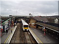
Residents of DA18 4ZX enjoy a range of amenities within practical reach, including five retail outlets such as Sainsburys Abbey, Lidl Thamesmead, and Morrisons Daily London. These shops provide everyday essentials, while the area’s proximity to multiple rail, ferry, and metro stations ensures easy access to wider London. The presence of London City Airport nearby adds to the convenience for those needing travel connections. Though the area is small, its transport links and retail options support a lifestyle that balances local convenience with broader mobility. The mix of retail, transport, and nearby green spaces (such as the canals and open areas designed into the 1960s plan) creates a functional environment for daily life. While the area may not have large-scale leisure facilities, its strategic location and accessibility make it a practical choice for those prioritising convenience over expansive amenities.
Amenities
Schools
Residents of DA18 4ZX have access to a range of educational institutions, including Thamesmead Community College, a primary school, and two academies: The Business Academy Bexley and Harris Garrard Academy. Harris Garrard Academy holds an Ofsted rating of 'good', which reflects its performance in teaching quality and student outcomes. The mix of primary and academy schools provides families with options that vary from traditional state education to academies with distinct curricula. The presence of two academies suggests a focus on specialist or vocational education, which may appeal to parents seeking specific learning environments for their children. However, the absence of secondary schools in the immediate area means that students may need to commute to nearby boroughs for higher education, a factor to consider for families prioritising school proximity.
| Rank | School | Type | Entry gender | Ages |
|---|
Explore more schools in this area
Go to Schools tabDemographics
DA18 4ZX has a median age of 47, with the majority of residents falling within the 30-64 age range. This suggests a mature, stable population, likely drawn to the area’s established housing stock and transport links. Home ownership is low at 30%, indicating that most residents are renters, which is typical for a planned development with a high proportion of flats. The predominant accommodation type is flats, reflecting the area’s original design as a high-density residential zone. The dominant ethnic group is Black, which shapes the community’s cultural and social dynamics. While no specific deprivation data is provided, the low home ownership rate and flat-dominated housing suggest a reliance on rental markets and shared living arrangements. This profile aligns with Thamesmead’s history as a post-war solution to housing shortages, where affordability and practicality have long been priorities over luxury.
Household Size
Accommodation Type
Tenure
Ethnic Group
Religion
Household Composition
Age
Household Deprivation
NS-SEC
Explore more demographic insights in this area
Go to Demographics tabPlanning
Planning Constraints
- Flood RiskPremium
- Ramsar Wetland SitesPremium
- Area of Outstanding Natural BeautyPremium
- Protected Nature ReservePremium
- Protected WoodlandPremium