Area Overview for DA18 4EH
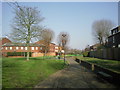
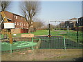
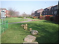
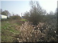
Photos of DA18 4EH


Area Information
DA18 4EH lies within Thamesmead, a post-war new town in south-east London, straddling the Royal Borough of Greenwich and London Borough of Bexley. Designed in the 1960s as part of the Greater London Council’s masterplan, the area was built to house 60,000 people, featuring elevated housing to counter flood risks after the 1953 North Sea Flood. With a population of 1,518, this small postcode area reflects a planned residential cluster, blending open spaces, canals, and modern infrastructure. Daily life here is shaped by its proximity to the River Thames and its role as a hub for commuters, with multiple transport links to central London. The area’s history as a post-war development means it combines practical design with a distinct identity, offering a mix of housing types and community amenities. While it lacks the density of older districts, its layout prioritises accessibility, with retail, transport, and leisure options within reach. For buyers, DA18 4EH represents a chance to live in a purpose-built area with a clear vision, though its character is defined by its functional, mid-20th-century origins.
- Area Type
- Postcode
- Area Size
- Not available
- Population
- Not available
- Population Density
- Not available
DA18 4EH is characterised by a rental-heavy property market, with only 32% of homes owned by residents. The accommodation type is predominantly houses, though the exact proportion of detached, semi-detached, or terraced properties is unspecified. This suggests a mix of housing stock, likely influenced by the area’s post-war design, which prioritised elevated, flood-resistant homes. The low home ownership rate indicates a strong presence of private rentals, which may affect property availability and market competition for buyers. For those seeking to purchase, the small postcode area means limited options, requiring buyers to look beyond immediate surroundings. The housing stock’s age and design—built in the 1960s—may present considerations regarding maintenance and modernisation. Despite this, the area’s planned layout and proximity to transport links could appeal to those prioritising practicality over historical charm.
House Prices in DA18 4EH
No properties found in this postcode.
Energy Efficiency in DA18 4EH
DA18 4EH offers a range of amenities within practical reach, enhancing daily life. Retail options include Sainsburys Abbey and Lidl Thamesmead, providing convenience for grocery shopping. The area’s proximity to ferry piers, such as Woolwich Arsenal Pier, adds to its accessibility, while rail and metro stations ensure easy travel. The presence of multiple transport hubs, including Abbey Wood Station and Barking Riverside, supports both commuting and leisure travel. Nearby leisure opportunities are not detailed, but the area’s planned design includes open spaces and waterways, suggesting potential for outdoor activities. The inclusion of London City Airport nearby further broadens connectivity. This mix of retail, transport, and waterfront access contributes to a functional lifestyle, though the absence of specific leisure venues means residents may need to venture further for cultural or recreational pursuits.
Amenities
Schools
The nearest school to DA18 4EH is Parkway Primary School, which holds a ‘good’ Ofsted rating. This institution serves the area’s primary education needs, though no secondary schools are listed in the data. The presence of a well-rated primary school is a key consideration for families with young children, offering a foundation for early education. However, parents seeking secondary schooling may need to look beyond the immediate vicinity, as the data does not mention nearby secondary schools. The single primary school suggests a focus on local provision, but the absence of higher education facilities within the area could influence long-term family planning. For those prioritising school quality, Parkway Primary’s rating provides a positive indicator, though additional research into secondary options would be necessary for a comprehensive view.
| Rank | School | Type | Entry gender | Ages |
|---|
Explore more schools in this area
Go to Schools tabDemographics
The population of DA18 4EH is 1,518, with a median age of 47, indicating a mature community. The most common age range is adults aged 30–64, suggesting a mix of established families and professionals. Home ownership here is relatively low at 32%, pointing to a rental-dominated market. The predominant accommodation type is houses, though the exact number of properties is not specified. The area’s demographic profile is notably shaped by its predominant ethnic group: Black residents make up the largest share, reflecting Thamesmead’s historical and social context. This composition influences the community’s dynamics, with a focus on stability and long-term residency. The age profile implies a population that is largely settled, with fewer young families compared to other areas. While deprivation data is not provided, the low home ownership rate and mature age group may indicate a reliance on local services and community networks for support.
Household Size
Accommodation Type
Tenure
Ethnic Group
Religion
Household Composition
Age
Household Deprivation
NS-SEC
Explore more demographic insights in this area
Go to Demographics tabPlanning
Planning Constraints
- Flood RiskPremium
- Ramsar Wetland SitesPremium
- Area of Outstanding Natural BeautyPremium
- Protected Nature ReservePremium
- Protected WoodlandPremium