Area Overview for DA18 4AN
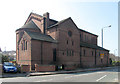
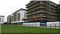
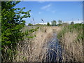
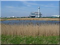
Photos of DA18 4AN


Area Information
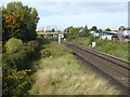
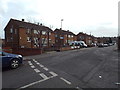
Living in DA18 4AN means residing in Thamesmead, a post-war new town in south-east London designed to house 60,000 people as part of the 1966 Greater London Council masterplan. The area’s elevated housing and man-made canals were engineered to prevent flooding after the 1953 North Sea Flood. With a population of 1,713 and a density of 726 people per square kilometre, DA18 4AN is a compact residential cluster. Its history as a planned development is evident in its layout, blending open spaces with residential blocks. The area’s proximity to the River Thames and its role as a filming location for *A Clockwork Orange* add cultural layers to daily life. Residents benefit from a mix of modern infrastructure and historical context, though the community’s character is shaped by its post-war origins. The area’s small size means amenities and services are concentrated, making it practical for those prioritising convenience over sprawling urban environments.
- Area Type
- Postcode
- Area Size
- Not available
- Population
- 1713
- Population Density
- 726 people/km²
The property market in DA18 4AN is characterised by a 30% home ownership rate, indicating that the majority of residents rent their homes. This suggests a rental market rather than a strong owner-occupied environment. The predominant accommodation type is flats, reflecting the area’s post-war construction and planned development. For buyers, this means limited availability of owner-occupied properties, with most housing stock catering to tenants. The small size of DA18 4AN and its immediate surroundings further restricts options, making the area competitive for those seeking to purchase. Renters may find the market stable, but buyers should consider the lack of private homeownership opportunities. The flat-dominated landscape also influences property values, which are likely shaped by the area’s historical and infrastructural context.
House Prices in DA18 4AN
No properties found in this postcode.
Energy Efficiency in DA18 4AN
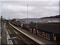
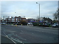
DA18 4AN’s lifestyle is shaped by its proximity to retail, transport, and leisure options. Nearby shops include Lidl Clydesdale Way, Asda Belvedere, and Co-op Upper, offering essential services. The area’s rail, metro, and ferry links ensure easy access to London’s transport network, with stations like Belvedere and Erith providing connections to central London. The presence of London City Airport adds to the area’s accessibility. While there is no direct mention of parks or recreational spaces, the historical context of Thamesmead includes canals and open areas. The mix of retail and transport options supports a practical, convenience-driven lifestyle, though residents may need to travel further for cultural or leisure amenities.
Amenities
Schools
Near DA18 4AN are three schools: Thamesmead Community College, a primary school; The Business Academy Bexley, an academy; and Harris Garrard Academy, also an academy with a ‘good’ Ofsted rating. The mix of primary and academy schools offers families diverse educational options, though no independent or grammar schools are listed. The presence of two academies suggests a focus on specialist or alternative education models. For parents, the ‘good’ rating at Harris Garrard Academy indicates a reliable secondary option. However, the absence of data on school catchment areas or performance metrics means families must assess proximity and suitability independently. The schools’ locations within practical reach of the area support daily commutes for students.
| Rank | School | Type | Entry gender | Ages |
|---|
Explore more schools in this area
Go to Schools tabDemographics
DA18 4AN has a median age of 47, with the majority of residents aged 30–64. This suggests a mature, stable population, though the 30% home ownership rate indicates that most households are renters. The area’s accommodation is predominantly flats, reflecting its post-war construction. The predominant ethnic group is Black, highlighting a distinct demographic profile. With a population density of 726 people per square kilometre, the area is moderately compact, balancing space with accessibility. The 30% home ownership rate implies limited opportunities for property investment, which may influence the local economy. For quality of life, this density could mean shared community spaces but also potential strain on local services. The age profile suggests a community focused on long-term stability, with fewer young families compared to other areas.
Household Size
Accommodation Type
Tenure
Ethnic Group
Religion
Household Composition
Age
Household Deprivation
NS-SEC
Explore more demographic insights in this area
Go to Demographics tabPlanning
Planning Constraints
- Flood RiskPremium
- Ramsar Wetland SitesPremium
- Area of Outstanding Natural BeautyPremium
- Protected Nature ReservePremium
- Protected WoodlandPremium