Area Overview for DA17 5SJ
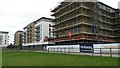
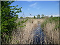
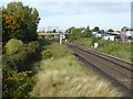
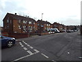
Photos of DA17 5SJ


Area Information
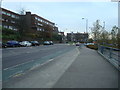
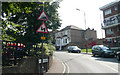
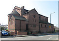
Living in DA17 5SJ means inhabiting a small, tightly knit residential cluster in the London Borough of Bexley. With a population of 1,854, this postcode area is defined by its Victorian-era development, where wooded estates were transformed into a village of semi-detached and terraced homes. Roads like Woolwich Road and Nuxley Road offer views of the River Thames and central London, blending suburban tranquillity with proximity to urban hubs. The area’s history dates to the 18th century, with landmarks such as All Saints’ Church and the Woolwich Road Conservation Area preserving its heritage. Daily life here is shaped by its mix of historic character and modern convenience, with nearby rail links to Abbey Wood and Erith, and easy access to London City Airport. The median age of 47 suggests a stable, established community, with many residents rooted in the area for decades. For those seeking a balance between heritage and practicality, DA17 5SJ offers a distinct identity: a quiet, low-density suburb with strong transport connections and a sense of continuity from its 19th-century origins.
- Area Type
- Postcode
- Area Size
- Not available
- Population
- Not available
- Population Density
- Not available
The property market in DA17 5SJ is dominated by owner-occupied homes, with 63% of properties in private hands. The accommodation type is primarily houses, reflecting the area’s legacy of Victorian and Edwardian-era development. This contrasts with many modern suburbs where flats or apartments predominate, suggesting a focus on traditional, family-sized homes. The small size of the postcode area means the housing stock is relatively limited, with semi-detached and terraced properties along roads like Woolwich Road and Albert Road. For buyers, this implies a market where properties are likely to be long-standing and well-maintained, with potential for character features such as period details. However, the limited availability of new builds or rental properties may make the area less attractive to those seeking investment opportunities or flexible tenancy options. The emphasis on owner-occupation also indicates a community where residents are likely to have a strong emotional and financial stake in their homes.
House Prices in DA17 5SJ
No properties found in this postcode.
Energy Efficiency in DA17 5SJ
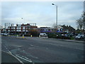
The lifestyle in DA17 5SJ is shaped by its proximity to a range of amenities, from retail to leisure. Within walking distance are shops such as Asda Belvedere, Lidl Clydesdale Way, and Co-op Upper, providing everyday essentials. The Woolwich Road Conservation Area adds character, with historic buildings like the Eardley Arms public house and All Saints’ Church at its heart. Residents can enjoy green spaces such as Belvedere Recreation Grounds, while the River Thames offers scenic walks and views of Canary Wharf. Ferry services from Woolwich Arsenal Pier and Barrier Gardens Pier provide access to the Thames’ cultural and recreational offerings. The area’s mix of historic charm and practical amenities makes it ideal for those seeking a balanced lifestyle, with easy access to both suburban tranquillity and urban connectivity.
Amenities
Schools
| Rank | School | Type | Entry gender | Ages |
|---|
Explore more schools in this area
Go to Schools tabDemographics
DA17 5SJ’s population of 1,854 is predominantly composed of adults aged 30–64, with a median age of 47. This suggests a community of long-term residents, many of whom are likely homeowners, as 63% of properties are owner-occupied. The area is characterised by houses rather than flats, reflecting a preference for traditional, family-friendly housing stock. The predominant ethnic group is White, though no specific data on diversity or deprivation is provided. The age profile indicates a mature, settled population, which may influence local amenities and services. With no significant student or younger family populations noted, the area appears to cater to middle-aged households seeking stability. The low proportion of rental properties suggests limited turnover, reinforcing a sense of continuity. This demographic profile aligns with the area’s historic development and its appeal to those prioritising established, low-density living over newer, high-density alternatives.
Household Size
Accommodation Type
Tenure
Ethnic Group
Religion
Household Composition
Age
Household Deprivation
NS-SEC
Explore more demographic insights in this area
Go to Demographics tabPlanning
Planning Constraints
- Flood RiskPremium
- Ramsar Wetland SitesPremium
- Area of Outstanding Natural BeautyPremium
- Protected Nature ReservePremium
- Protected WoodlandPremium
- Crime RiskPremium