Area Overview for DA17 5QL
Photos of DA17 5QL

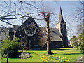
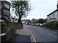
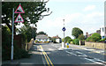
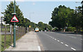

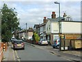


93 photos from this area
Area Information
Key information about the DA17 5QL including its size, population, and administrative classification.
- Area Type
- Postcode
- Area Size
- 1.7 hectares
- Population
- Not available
- Population Density
- Not available
House Prices in DA17 5QL
60
Properties
£235,254
Average Sold Price
£14,080
Lowest Price
£545,000
Highest Price
Showing 60 properties
| Address | Type | Beds | Baths | Last Sale Price | Last Sale Date | |
|---|---|---|---|---|---|---|
| 145 Picardy Road, Belvedere, DA17 5QL | Semi-detached | 3 | 1 | £545,000 | Feb 2025 | |
| 167A Picardy Road, Belvedere, DA17 5QL | Detached | 4 | 2 | £530,000 | Jul 2024 | |
| 83 Picardy Road, Belvedere, DA17 5QL | Flat | 2 | 1 | £14,080 | Jun 2023 | |
| 169A Picardy Road, Belvedere, DA17 5QL | house | - | - | £376,000 | Mar 2022 | |
| 111 Picardy Road, Belvedere, DA17 5QL | Terraced | 3 | 1 | £380,000 | Feb 2020 | |
| 93 Picardy Road, Belvedere, DA17 5QL | Terraced | 3 | 2 | £343,000 | Feb 2017 | |
| 115 Picardy Road, Belvedere, DA17 5QL | house | 3 | - | £335,000 | Feb 2016 | |
| 79 Picardy Road, Belvedere, DA17 5QL | Detached | 3 | 1 | £196,000 | Jan 2014 | |
| 107 Picardy Road, Belvedere, DA17 5QL | house | 2 | - | £168,500 | Feb 2011 | |
| 157 Picardy Road, Belvedere, DA17 5QL | Terraced | 3 | 1 | £195,000 | Oct 2010 |
Page 1 of 6
Energy Efficiency in DA17 5QL
Amenities
Schools
| Rank | School | Type | Entry gender | Ages |
|---|
Explore more schools in this area
Go to Schools tabDemographics
Household Size
Family (3-5 people)
most common
Accommodation Type
Houses
most common
Tenure
77
majority
Ethnic Group
White
most common
Religion
N/A
most common
Household Composition
N/A
most common
Age
47
median
Adults (30-64 years)
most common
Household Deprivation
N/A
with no deprivation
NS-SEC
33
in Lower managerial occupations
Explore more demographic insights in this area
Go to Demographics tabPlanning
Planning Constraints
- Flood RiskPremium
- Ramsar Wetland SitesPremium
- Area of Outstanding Natural BeautyPremium
- Protected Nature ReservePremium
- Protected WoodlandPremium