Area Overview for DA17 5EU
Photos of DA17 5EU
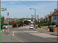
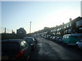
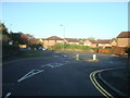

100 photos from this area
Area Information
Key information about the DA17 5EU including its size, population, and administrative classification.
- Area Type
- Postcode
- Area Size
- 5.6 hectares
- Population
- 1736
- Population Density
- 6320 people/km²
House Prices in DA17 5EU
35
Properties
£228,444
Average Sold Price
£44,000
Lowest Price
£440,000
Highest Price
Showing 35 properties
| Address | Type | Beds | Baths | Last Sale Price | Last Sale Date | |
|---|---|---|---|---|---|---|
| 26 Raglan Road, Belvedere, DA17 5EU | Terraced | 3 | 1 | £333,000 | Oct 2025 | |
| 34 Raglan Road, Belvedere, DA17 5EU | Flat | 2 | 1 | £292,000 | Mar 2025 | |
| 2 Raglan Road, Belvedere, DA17 5EU | Semi-detached | 3 | - | £350,000 | Feb 2025 | |
| 25 Raglan Road, Belvedere, DA17 5EU | Flat | - | - | £250,000 | Aug 2024 | |
| 7 Raglan Road, Belvedere, DA17 5EU | Bungalow | - | - | £440,000 | Oct 2021 | |
| 30 Raglan Road, Belvedere, DA17 5EU | Terraced | 3 | 1 | £325,000 | Jan 2021 | |
| 4 Raglan Road, Belvedere, DA17 5EU | Semi-detached | 2 | 1 | £285,000 | Mar 2019 | |
| 1 Raglan Road, Belvedere, DA17 5EU | house | - | - | £300,000 | Mar 2019 | |
| 15 Raglan Road, Belvedere, DA17 5EU | Maisonette | 2 | 1 | £220,000 | Feb 2019 | |
| 3 Raglan Road, Belvedere, DA17 5EU | house | 3 | 3 | £340,000 | Jan 2019 |
Page 1 of 4
Energy Efficiency in DA17 5EU
Amenities
Schools
| Rank | School | Type | Entry gender | Ages |
|---|
Explore more schools in this area
Go to Schools tabDemographics
Household Size
Family (3-5 people)
most common
Accommodation Type
Houses
most common
Tenure
62
majority
Ethnic Group
White
most common
Religion
N/A
most common
Household Composition
N/A
most common
Age
47
median
Adults (30-64 years)
most common
Household Deprivation
N/A
with no deprivation
NS-SEC
28
in Lower managerial occupations
Explore more demographic insights in this area
Go to Demographics tabPlanning
Planning Constraints
- Flood RiskPremium
- Ramsar Wetland SitesPremium
- Area of Outstanding Natural BeautyPremium
- Protected Nature ReservePremium
- Protected WoodlandPremium