Area Overview for DA16 3RT
Photos of DA16 3RT
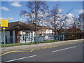
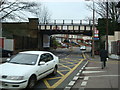
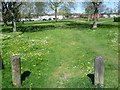
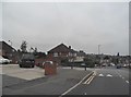
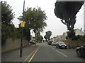

100 photos from this area
Area Information
Key information about the DA16 3RT including its size, population, and administrative classification.
- Area Type
- Postcode
- Area Size
- 2.1 hectares
- Population
- 1571
- Population Density
- 5391 people/km²
House Prices in DA16 3RT
58
Properties
£311,460
Average Sold Price
£93,750
Lowest Price
£655,000
Highest Price
Showing 58 properties
| Address | Type | Beds | Baths | Last Sale Price | Last Sale Date | |
|---|---|---|---|---|---|---|
| 286 Bellegrove Road, Welling, DA16 3RT | Semi-detached | 4 | 1 | £655,000 | Dec 2024 | |
| 206 Bellegrove Road, Welling, DA16 3RT | Flat | 2 | 2 | £335,000 | Aug 2024 | |
| 220 Bellegrove Road, Welling, DA16 3RT | Maisonette | 2 | - | £325,000 | Feb 2023 | |
| 262 Bellegrove Road, Welling, DA16 3RT | Retail | 3 | 1 | £580,000 | Sep 2022 | |
| 268 Bellegrove Road, Welling, DA16 3RT | house | - | - | £545,000 | Oct 2021 | |
| 226 Bellegrove Road, Welling, DA16 3RT | Maisonette | 2 | 1 | £285,000 | Mar 2021 | |
| 222 Bellegrove Road, Welling, DA16 3RT | Maisonette | - | - | £280,000 | Jan 2021 | |
| 208 Bellegrove Road, Welling, DA16 3RT | Maisonette | 2 | 1 | £280,000 | Jul 2020 | |
| 230A Bellegrove Road, Welling, DA16 3RT | Maisonette | 2 | 1 | £264,500 | May 2020 | |
| 254 Bellegrove Road, Welling, DA16 3RT | Semi-detached | 4 | 1 | £540,000 | Jun 2019 |
Page 1 of 6
Energy Efficiency in DA16 3RT
Amenities
Schools
| Rank | School | Type | Entry gender | Ages |
|---|
Explore more schools in this area
Go to Schools tabDemographics
Household Size
Family (3-5 people)
most common
Accommodation Type
Houses
most common
Tenure
79
majority
Ethnic Group
White
most common
Religion
N/A
most common
Household Composition
N/A
most common
Age
47
median
Adults (30-64 years)
most common
Household Deprivation
N/A
with no deprivation
NS-SEC
35
in Lower managerial occupations
Explore more demographic insights in this area
Go to Demographics tabPlanning
Planning Constraints
- Flood RiskPremium
- Ramsar Wetland SitesPremium
- Area of Outstanding Natural BeautyPremium
- Protected Nature ReservePremium
- Protected WoodlandPremium