Area Overview for DA16 3DX
Photos of DA16 3DX

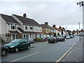
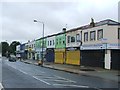
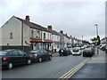
93 photos from this area
Area Information
Key information about the DA16 3DX including its size, population, and administrative classification.
- Area Type
- Postcode
- Area Size
- 2593 m²
- Population
- 1816
- Population Density
- 6728 people/km²
House Prices in DA16 3DX
16
Properties
£192,400
Average Sold Price
£72,000
Lowest Price
£415,000
Highest Price
Showing 16 properties
| Address | Type | Beds | Baths | Last Sale Price | Last Sale Date | |
|---|---|---|---|---|---|---|
| 166 Upper Wickham Lane, Welling, DA16 3DX | Terraced | 3 | 2 | £301,000 | Oct 2023 | |
| 152 Upper Wickham Lane, Welling, DA16 3DX | Terraced | 2 | 1 | £335,000 | Aug 2021 | |
| 156 Upper Wickham Lane, Welling, DA16 3DX | Semi-detached | 3 | 2 | £415,000 | Oct 2020 | |
| 148A Upper Wickham Lane, Welling, DA16 3DX | Flat | - | - | £110,000 | Mar 2013 | |
| 146A Upper Wickham Lane, Welling, DA16 3DX | Maisonette | 1 | 1 | £90,000 | Apr 2012 | |
| 162 Upper Wickham Lane, Welling, DA16 3DX | house | - | - | £160,000 | Apr 2006 | |
| 168 Upper Wickham Lane, Welling, DA16 3DX | house | 1 | - | £220,000 | Feb 2006 | |
| 160 Upper Wickham Lane, Welling, DA16 3DX | Flat | - | - | £72,000 | Dec 2003 | |
| 154 Upper Wickham Lane, Welling, DA16 3DX | house | 2 | - | £135,000 | Aug 2002 | |
| 150 Upper Wickham Lane, Welling, DA16 3DX | Terraced | 2 | 1 | £86,000 | Aug 2001 |
Page 1 of 2
Energy Efficiency in DA16 3DX
Amenities
Schools
| Rank | School | Type | Entry gender | Ages |
|---|
Explore more schools in this area
Go to Schools tabDemographics
Household Size
Family (3-5 people)
most common
Accommodation Type
Houses
most common
Tenure
55
majority
Ethnic Group
White
most common
Religion
N/A
most common
Household Composition
N/A
most common
Age
47
median
Adults (30-64 years)
most common
Household Deprivation
N/A
with no deprivation
NS-SEC
26
in Lower managerial occupations
Explore more demographic insights in this area
Go to Demographics tabPlanning
Planning Constraints
- Flood RiskPremium
- Ramsar Wetland SitesPremium
- Area of Outstanding Natural BeautyPremium
- Protected Nature ReservePremium
- Protected WoodlandPremium