Area Overview for DA16 2RS
Photos of DA16 2RS
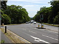
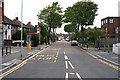
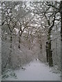
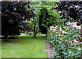

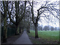
100 photos from this area
Area Information
Key information about the DA16 2RS including its size, population, and administrative classification.
- Area Type
- Postcode
- Area Size
- 1.4 hectares
- Population
- 1452
- Population Density
- 6627 people/km²
House Prices in DA16 2RS
33
Properties
£361,360
Average Sold Price
£128,000
Lowest Price
£667,000
Highest Price
Showing 33 properties
| Address | Type | Beds | Baths | Last Sale Price | Last Sale Date | |
|---|---|---|---|---|---|---|
| 154 Welling Way, Welling, DA16 2RS | Semi-detached | 3 | 1 | £667,000 | Feb 2024 | |
| 166 Welling Way, Welling, DA16 2RS | Semi-detached | 3 | 1 | £520,000 | Oct 2023 | |
| 146 Welling Way, Welling, DA16 2RS | Semi-detached | 5 | 2 | £610,000 | Aug 2022 | |
| 170 Welling Way, Welling, DA16 2RS | house | - | - | £650,000 | Feb 2022 | |
| 190 Welling Way, Welling, DA16 2RS | Semi-detached | 4 | 2 | £580,000 | Mar 2021 | |
| 134 Welling Way, Welling, DA16 2RS | Semi-detached | 3 | 1 | £420,000 | Nov 2017 | |
| 178 Welling Way, Welling, DA16 2RS | Semi-detached | 4 | - | £520,000 | Dec 2016 | |
| 168 Welling Way, Welling, DA16 2RS | Semi-detached | 3 | 1 | £425,000 | Jul 2016 | |
| 148 Welling Way, Welling, DA16 2RS | Semi-detached | 5 | 2 | £400,000 | Jan 2015 | |
| 162 Welling Way, Welling, DA16 2RS | Semi-detached | 5 | - | £400,000 | Jun 2014 |
Page 1 of 4
Energy Efficiency in DA16 2RS
Amenities
Schools
| Rank | School | Type | Entry gender | Ages |
|---|
Explore more schools in this area
Go to Schools tabDemographics
Household Size
Family (3-5 people)
most common
Accommodation Type
Houses
most common
Tenure
90
majority
Ethnic Group
White
most common
Religion
N/A
most common
Household Composition
N/A
most common
Age
47
median
Adults (30-64 years)
most common
Household Deprivation
N/A
with no deprivation
NS-SEC
38
in Lower managerial occupations
Explore more demographic insights in this area
Go to Demographics tabPlanning
Planning Constraints
- Flood RiskPremium
- Ramsar Wetland SitesPremium
- Area of Outstanding Natural BeautyPremium
- Protected Nature ReservePremium
- Protected WoodlandPremium