Area Overview for DA16 2NJ
Photos of DA16 2NJ
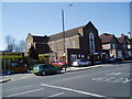

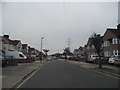

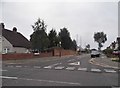
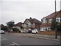
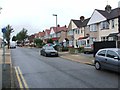
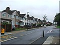
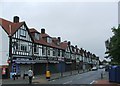
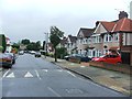
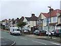
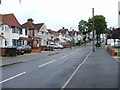
60 photos from this area
Area Information
Key information about the DA16 2NJ including its size, population, and administrative classification.
- Area Type
- Postcode
- Area Size
- 1.3 hectares
- Population
- 1658
- Population Density
- 6084 people/km²
House Prices in DA16 2NJ
52
Properties
£270,875
Average Sold Price
£65,000
Lowest Price
£435,000
Highest Price
Showing 52 properties
| Address | Type | Beds | Baths | Last Sale Price | Last Sale Date | |
|---|---|---|---|---|---|---|
| 251 Sutherland Avenue, Welling, DA16 2NJ | Terraced | 2 | 2 | £415,000 | Aug 2025 | |
| 283 Sutherland Avenue, Welling, DA16 2NJ | Terraced | 2 | 1 | £415,000 | Jan 2024 | |
| 225 Sutherland Avenue, Welling, DA16 2NJ | house | 2 | 1 | £430,000 | Oct 2022 | |
| 223 Sutherland Avenue, Welling, DA16 2NJ | Terraced | 2 | 1 | £390,000 | Apr 2022 | |
| 275 Sutherland Avenue, Welling, DA16 2NJ | house | - | - | £390,000 | Mar 2022 | |
| 201 Sutherland Avenue, Welling, DA16 2NJ | Terraced | 2 | 1 | £406,000 | Feb 2022 | |
| 207 Sutherland Avenue, Welling, DA16 2NJ | house | 3 | 1 | £415,000 | Mar 2021 | |
| 253 Sutherland Avenue, Welling, DA16 2NJ | Terraced | 3 | 1 | £407,000 | Sep 2020 | |
| 209 Sutherland Avenue, Welling, DA16 2NJ | house | - | - | £435,000 | Nov 2019 | |
| 269 Sutherland Avenue, Welling, DA16 2NJ | house | 2 | - | £358,000 | Jun 2019 |
Page 1 of 6
Energy Efficiency in DA16 2NJ
Amenities
Schools
| Rank | School | Type | Entry gender | Ages |
|---|
Explore more schools in this area
Go to Schools tabDemographics
Household Size
Family (3-5 people)
most common
Accommodation Type
Houses
most common
Tenure
87
majority
Ethnic Group
White
most common
Religion
N/A
most common
Household Composition
N/A
most common
Age
47
median
Adults (30-64 years)
most common
Household Deprivation
N/A
with no deprivation
NS-SEC
36
in Lower managerial occupations
Explore more demographic insights in this area
Go to Demographics tabPlanning
Planning Constraints
- Flood RiskPremium
- Ramsar Wetland SitesPremium
- Area of Outstanding Natural BeautyPremium
- Protected Nature ReservePremium
- Protected WoodlandPremium