Area Overview for DA15 9ZP
Photos of DA15 9ZP


Area Information
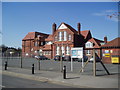
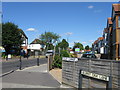
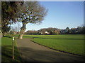
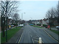
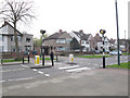
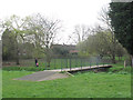
DA15 9ZP is a small residential cluster in the London Borough of Bexley, situated between Bexleyheath and Sidcup. With a population of 1588, it is a tightly knit community characterised by a stable, middle-class demographic. The area’s history is rooted in suburban development, with Blendon Hall, once a local landmark, giving way to modern housing. Residents benefit from proximity to key transport hubs, including Sidcup Station and Welling Station, which link to broader London networks. The area’s blend of residential tranquility and practical connectivity makes it appealing for families and professionals. Nearby, Sherwood Park Primary School offers a good Ofsted-rated education for younger residents. The low crime score of 91/100 underscores its safety, while digital connectivity scores of 100 for broadband and 85 for mobile coverage support both remote work and everyday internet needs. Living here means balancing suburban comfort with access to urban amenities, all within a compact, well-defined postcode area.
- Area Type
- Postcode
- Area Size
- Not available
- Population
- 1588
- Population Density
- 4563 people/km²
DA15 9ZP is primarily an owner-occupied area, with 90% of homes owned by residents rather than rented. The accommodation type is almost exclusively houses, which is unusual for a small postcode area but reflects the suburban character of the neighbourhood. This suggests a market skewed towards family homes, with limited rental availability. The concentration of houses implies a focus on private, spacious living, which may appeal to buyers seeking stability and long-term investment. Given the area’s proximity to transport links and schools, properties here are likely to hold value, though the small size of the postcode means the immediate surroundings are key for buyers considering wider housing options.
House Prices in DA15 9ZP
No properties found in this postcode.
Energy Efficiency in DA15 9ZP
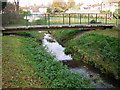
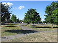
DA15 9ZP offers a range of amenities within practical reach. Retail options include The Southern Co-operative Co-op, Waitrose Little, and Spar, providing everyday shopping needs. Transport links are extensive, with rail, ferry, metro, and airport access ensuring ease of movement. The area’s proximity to London City Airport and major stations like Welling and Sidcup enhances its connectivity. While parks and leisure facilities are not explicitly listed, the surrounding area includes historical sites like Blendon Hall’s former location, adding cultural interest. The small cluster of shops and transport hubs supports a convenient, self-contained lifestyle, though residents may need to venture slightly further for more extensive leisure options.
Amenities
Schools
The nearest school to DA15 9ZP is Sherwood Park Primary School, which serves the local community with a primary education offering. The school holds a ‘good’ Ofsted rating, reflecting its effectiveness in delivering education. As a primary school, it caters to younger children, making it a critical factor for families prioritising quality schooling. The absence of secondary schools in the immediate vicinity means residents may need to consider nearby areas for secondary education. However, the presence of a well-rated primary school enhances the area’s appeal for families, ensuring children receive a solid educational foundation before transitioning to higher levels of schooling.
| Rank | School | Type | Entry gender | Ages |
|---|---|---|---|---|
| 1 | Sherwood Park Primary School | primary | N/A | N/A |
| 2 | Sherwood Park Primary School | primary | N/A | N/A |
Explore more schools in this area
Go to Schools tabDemographics
DA15 9ZP has a median age of 47, with the majority of residents falling within the 30-64 age range. This suggests a mature, established community with strong family ties. Home ownership is high at 90%, indicating a stable, long-term resident base. The accommodation type is predominantly houses, reflecting a preference for private, spacious living. The predominant ethnic group is White, aligning with broader trends in the area. With a population of 1588, the community is small but cohesive. The high home ownership rate and age profile suggest a focus on long-term residency rather than transient populations. This demographic profile supports a quiet, low-deprivation environment, where quality of life is maintained through stable housing and community continuity.
Household Size
Accommodation Type
Tenure
Ethnic Group
Religion
Household Composition
Age
Household Deprivation
NS-SEC
Explore more demographic insights in this area
Go to Demographics tabPlanning
Planning Constraints
- Flood RiskPremium
- Ramsar Wetland SitesPremium
- Area of Outstanding Natural BeautyPremium
- Protected Nature ReservePremium
- Protected WoodlandPremium
- Crime RiskPremium