Area Overview for DA15 9JF
Photos of DA15 9JF
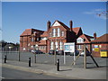
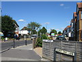
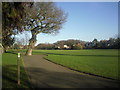
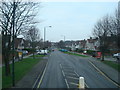


67 photos from this area
Area Information
Key information about the DA15 9JF including its size, population, and administrative classification.
- Area Type
- Postcode
- Area Size
- 4632 m²
- Population
- 1588
- Population Density
- 4563 people/km²
House Prices in DA15 9JF
20
Properties
£319,593
Average Sold Price
£175,700
Lowest Price
£470,000
Highest Price
Showing 20 properties
| Address | Type | Beds | Baths | Last Sale Price | Last Sale Date | |
|---|---|---|---|---|---|---|
| 128 Ramillies Road, Sidcup, DA15 9JF | Terraced | - | - | £372,500 | Aug 2023 | |
| 152 Ramillies Road, Sidcup, DA15 9JF | Terraced | 2 | 1 | £335,000 | Dec 2022 | |
| 132 Ramillies Road, Sidcup, DA15 9JF | Retail | 2 | 1 | £356,100 | Sep 2022 | |
| 160 Ramillies Road, Sidcup, DA15 9JF | Terraced | 2 | - | £367,500 | May 2021 | |
| 148 Ramillies Road, Sidcup, DA15 9JF | Terraced | 3 | - | £470,000 | Apr 2021 | |
| 146 Ramillies Road, Sidcup, DA15 9JF | Terraced | 3 | 1 | £350,000 | Nov 2020 | |
| 138 Ramillies Road, Sidcup, DA15 9JF | Terraced | 3 | 1 | £377,500 | Jan 2020 | |
| 162 Ramillies Road, Sidcup, DA15 9JF | house | 2 | 1 | £312,500 | Dec 2019 | |
| 158 Ramillies Road, Sidcup, DA15 9JF | Terraced | 2 | - | £365,000 | Dec 2019 | |
| 130 Ramillies Road, Sidcup, DA15 9JF | Terraced | 2 | 1 | £362,500 | Jun 2019 |
Page 1 of 2
Energy Efficiency in DA15 9JF
Amenities
Schools
| Rank | School | Type | Entry gender | Ages |
|---|
Explore more schools in this area
Go to Schools tabDemographics
Household Size
Family (3-5 people)
most common
Accommodation Type
Houses
most common
Tenure
90
majority
Ethnic Group
White
most common
Religion
N/A
most common
Household Composition
N/A
most common
Age
47
median
Adults (30-64 years)
most common
Household Deprivation
N/A
with no deprivation
NS-SEC
34
in Lower managerial occupations
Explore more demographic insights in this area
Go to Demographics tabPlanning
Planning Constraints
- Flood RiskPremium
- Ramsar Wetland SitesPremium
- Area of Outstanding Natural BeautyPremium
- Protected Nature ReservePremium
- Protected WoodlandPremium