Area Overview for DA15 8QS
Photos of DA15 8QS

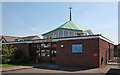
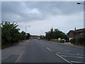

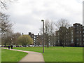
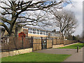
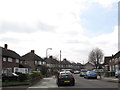
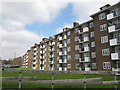
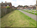
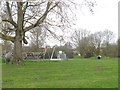
72 photos from this area
Area Information
Key information about the DA15 8QS including its size, population, and administrative classification.
- Area Type
- Postcode
- Area Size
- 1.5 hectares
- Population
- 1542
- Population Density
- 6346 people/km²
House Prices in DA15 8QS
56
Properties
£278,048
Average Sold Price
£49,000
Lowest Price
£605,000
Highest Price
Showing 56 properties
| Address | Type | Beds | Baths | Last Sale Price | Last Sale Date | |
|---|---|---|---|---|---|---|
| 32 Fairfield Close, Sidcup, DA15 8QS | Semi-detached | 3 | 2 | £450,000 | May 2024 | |
| 20 Fairfield Close, Sidcup, DA15 8QS | Semi-detached | 3 | 2 | £605,000 | Mar 2024 | |
| 39 Fairfield Close, Sidcup, DA15 8QS | Flat | - | - | £250,000 | Nov 2023 | |
| 28 Fairfield Close, Sidcup, DA15 8QS | Semi-detached | 3 | 1 | £465,000 | Sep 2022 | |
| 2 Fairfield Close, Sidcup, DA15 8QS | Retail | 3 | 1 | £438,000 | Apr 2022 | |
| 43 Fairfield Close, Sidcup, DA15 8QS | Maisonette | 2 | 1 | £275,000 | Sep 2021 | |
| 29 Fairfield Close, Sidcup, DA15 8QS | Semi-detached | 3 | 2 | £450,000 | Aug 2021 | |
| 24 Fairfield Close, Sidcup, DA15 8QS | Semi-detached | 3 | - | £470,000 | Jun 2021 | |
| 8 Fairfield Close, Sidcup, DA15 8QS | house | - | - | £332,500 | Nov 2020 | |
| 25 Fairfield Close, Sidcup, DA15 8QS | house | - | - | £460,000 | Oct 2020 |
Page 1 of 6
Energy Efficiency in DA15 8QS
Amenities
Schools
| Rank | School | Type | Entry gender | Ages |
|---|
Explore more schools in this area
Go to Schools tabDemographics
Household Size
Family (3-5 people)
most common
Accommodation Type
Houses
most common
Tenure
87
majority
Ethnic Group
White
most common
Religion
N/A
most common
Household Composition
N/A
most common
Age
47
median
Adults (30-64 years)
most common
Household Deprivation
N/A
with no deprivation
NS-SEC
31
in Lower managerial occupations
Explore more demographic insights in this area
Go to Demographics tabPlanning
Planning Constraints
- Flood RiskPremium
- Ramsar Wetland SitesPremium
- Area of Outstanding Natural BeautyPremium
- Protected Nature ReservePremium
- Protected WoodlandPremium