Area Overview for DA15 8DL
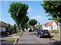
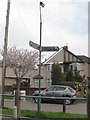
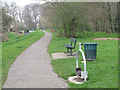
Photos of DA15 8DL


Area Information
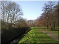
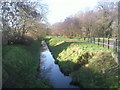
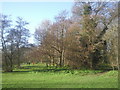
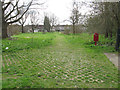
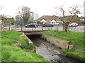
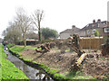
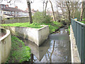
DA15 8DL is a small, residential postcode area in the London Borough of Bexley, situated between Sidcup and Welling. With a population of 1,592, it is a compact community characterised by 1930s owner-occupied housing, reflecting interwar development on former farmland. The area’s name, Blackfen, derives from its historical marshy terrain, now transformed into a suburban landscape. Residents benefit from proximity to Danson Park, a green space rooted in the former Danson Estate, and local amenities like the George Staples pub, rebuilt in 1931. The area’s layout includes conventional British housing designs, with infrastructure improvements such as roundabouts and parades enhancing connectivity. While some parts, like Blackfen Road, face periodic flooding risks, the overall environment is low-maintenance and family-friendly. DA15 8DL offers a quiet, established living experience with a focus on traditional housing, making it appealing to those seeking stability in a well-connected suburban setting.
- Area Type
- Postcode
- Area Size
- Not available
- Population
- 1592
- Population Density
- 7026 people/km²
DA15 8DL is a low-density, owner-occupied area with 85% of homes owned by residents, reflecting a long-term, stable housing market. The predominant accommodation type is houses, primarily built in the 1930s, offering conventional British designs. This suggests a market skewed towards established properties rather than newer developments or rental units. The small postcode area’s limited size means housing stock is finite, with little scope for new builds. Buyers should expect traditional, mature homes that require minimal modernisation, though flood risks in specific locations like Blackfen Road may necessitate careful consideration. The area’s proximity to transport links, including rail and metro stations, adds to its appeal for commuters, though the small scale of the area means buyers must prioritise proximity to amenities and infrastructure.
House Prices in DA15 8DL
No properties found in this postcode.
Energy Efficiency in DA15 8DL
DA15 8DL offers a blend of local shops, dining, and green spaces. Retail options include Morrisons Daily, Co-op Valliers, and Co-op University of, providing everyday essentials. The area’s transport links, such as New Eltham Station and Woolwich Arsenal Pier, facilitate access to broader leisure opportunities. Danson Park, rooted in the former Danson Estate, offers recreational space, while the George Staples pub (rebuilt in 1931) and micropubs contribute to a local social scene. Gloucester Parade and other parades host community events, and historical sites like Grade II-listed Lamorbey House (now Rose Bruford College) add cultural value. The mix of retail, transport, and green spaces supports a convenient, suburban lifestyle with opportunities for both relaxation and connectivity.
Amenities
Schools
| Rank | School | Type | Entry gender | Ages |
|---|
Explore more schools in this area
Go to Schools tabDemographics
The population of DA15 8DL is 1,592, with a median age of 47, indicating a mature community. The most common age range is adults aged 30–64, suggesting a stable demographic with a strong presence of middle-aged residents. Home ownership is high at 85%, reflecting a predominantly owner-occupied area, with 1930s houses as the primary accommodation type. The predominant ethnic group is White, though no specific diversity statistics are provided. This age profile and ownership pattern suggest a community with long-term residents, likely prioritising stability and low turnover. The absence of significant deprivation data implies a generally consistent quality of life, with households likely focused on maintaining property values and local amenities. The area’s character is defined by its suburban, family-oriented appeal, with minimal rental market activity.
Household Size
Accommodation Type
Tenure
Ethnic Group
Religion
Household Composition
Age
Household Deprivation
NS-SEC
Explore more demographic insights in this area
Go to Demographics tabPlanning
Planning Constraints
- Flood RiskPremium
- Ramsar Wetland SitesPremium
- Area of Outstanding Natural BeautyPremium
- Protected Nature ReservePremium
- Protected WoodlandPremium