Area Overview for DA15 7NQ
Photos of DA15 7NQ
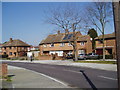


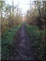
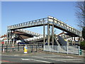
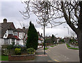
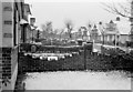
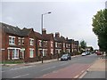
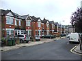
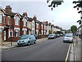
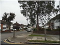
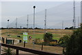
56 photos from this area
Area Information
Key information about the DA15 7NQ including its size, population, and administrative classification.
- Area Type
- Postcode
- Area Size
- 7300 m²
- Population
- 1800
- Population Density
- 4906 people/km²
House Prices in DA15 7NQ
19
Properties
£398,265
Average Sold Price
£224,000
Lowest Price
£675,000
Highest Price
Showing 19 properties
| Address | Type | Beds | Baths | Last Sale Price | Last Sale Date | |
|---|---|---|---|---|---|---|
| 110 Longlands Park Crescent, Sidcup, DA15 7NQ | Terraced | 3 | 2 | £497,500 | Nov 2023 | |
| 110A Longlands Park Crescent, Sidcup, DA15 7NQ | house | - | - | £224,000 | Jul 2022 | |
| 88 Longlands Park Crescent, Sidcup, DA15 7NQ | house | - | - | £675,000 | Mar 2021 | |
| 100 Longlands Park Crescent, Sidcup, DA15 7NQ | Semi-detached | 3 | 1 | £510,000 | Mar 2021 | |
| 108 Longlands Park Crescent, Sidcup, DA15 7NQ | Terraced | 3 | 1 | £425,000 | Jun 2019 | |
| 90 Longlands Park Crescent, Sidcup, DA15 7NQ | Semi-detached | 5 | - | £595,000 | Jan 2019 | |
| 106 Longlands Park Crescent, Sidcup, DA15 7NQ | Terraced | 3 | 1 | £392,500 | Mar 2016 | |
| 104 Longlands Park Crescent, Sidcup, DA15 7NQ | house | 4 | - | £462,500 | Jan 2016 | |
| 114 Longlands Park Crescent, Sidcup, DA15 7NQ | Semi-detached | 3 | - | £365,000 | Apr 2015 | |
| 112 Longlands Park Crescent, Sidcup, DA15 7NQ | Semi-detached | 4 | 1 | £355,000 | Dec 2012 |
Page 1 of 2
Energy Efficiency in DA15 7NQ
Amenities
Schools
| Rank | School | Type | Entry gender | Ages |
|---|
Explore more schools in this area
Go to Schools tabDemographics
Household Size
Family (3-5 people)
most common
Accommodation Type
Houses
most common
Tenure
95
majority
Ethnic Group
White
most common
Religion
N/A
most common
Household Composition
N/A
most common
Age
47
median
Adults (30-64 years)
most common
Household Deprivation
N/A
with no deprivation
NS-SEC
41
in Lower managerial occupations
Explore more demographic insights in this area
Go to Demographics tabPlanning
Planning Constraints
- Flood RiskPremium
- Ramsar Wetland SitesPremium
- Area of Outstanding Natural BeautyPremium
- Protected Nature ReservePremium
- Protected WoodlandPremium