Area Overview for DA14 5DA
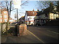
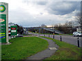
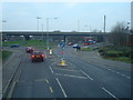
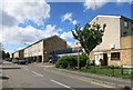
Photos of DA14 5DA


Area Information
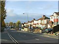
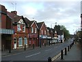
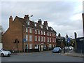
DA14 5DA is a small, densely populated residential postcode in south-east London, encompassing parts of the Sidcup area. With a population of 2,006 spread across 1,423 square metres, it reflects a suburban character shaped by 1930s housing estates. The area’s compact size and high population density create a tightly knit community, though its proximity to London’s transport networks ensures easy access to the capital. Historically, Sidcup evolved from a medieval hamlet into a commuter suburb, with interwar development defining its architectural identity. Today, it balances suburban tranquillity with connectivity, offering residents a mix of local amenities and links to broader urban infrastructure. The area’s demographics suggest a mature population, with a median age of 47 and a majority of residents in the 30–64 age bracket. This suggests a stable, established community, likely centred around family homes and long-term residency.
- Area Type
- Postcode
- Area Size
- 1423 m²
- Population
- 2006
- Population Density
- 3358 people/km²
DA14 5DA is a predominantly owner-occupied area, with 52% of residents owning their homes. The housing stock is almost entirely composed of houses, reflecting a suburban, family-oriented character. This contrasts with areas dominated by flats or rental properties, suggesting a focus on long-term residency and stability. The small size of the postcode and its high population density indicate a limited number of properties, which may drive competition among buyers. The presence of 1930s housing estates like Penhill Park and Albany Park suggests a mix of older, established homes and possibly some modernisations. For buyers, this means a market where properties are likely to be in demand, particularly for those seeking a traditional suburban lifestyle. However, the limited availability of properties may also mean higher prices or fewer options for those entering the market. The area’s proximity to transport links and amenities further enhances its appeal to homebuyers prioritising connectivity and convenience.
House Prices in DA14 5DA
Showing 2 properties
| Address | Type | Beds | Baths | Last Sale Price | Last Sale Date | |
|---|---|---|---|---|---|---|
| Nexus House, 2 Cray Road, Sidcup, DA14 5DA | office_workshop | - | - | - | - | |
| Second Floor, Nexus House, 2 Cray Road, Sidcup, DA14 5DA | Office | - | - | - | - |
Energy Efficiency in DA14 5DA
Residents of DA14 5DA have access to a range of nearby amenities, including five retail outlets such as Lidl Foots, M&S Bypass BP, and Tesco Sidcup, ensuring everyday shopping needs are met. The area’s rail network, with stations like Albany Park and St Mary Cray, provides direct links to London, while ferry piers offer alternative transport routes. The suburban character of the area, with its 1930s housing estates, suggests a focus on family living, though specific details on parks or leisure facilities are not provided. The proximity to retail and transport hubs indicates a practical, convenience-driven lifestyle, ideal for commuters. However, the absence of named parks or recreational spaces means the area’s green spaces remain unspecified, leaving potential buyers to investigate further for details on local amenities beyond shopping and transport.
Amenities
Schools
Residents of DA14 5DA have access to a range of educational institutions, including North Cray Primary School, an established primary school serving younger children. For independent education, Harenc School offers a private alternative, while Hope Community School, an academy with a Good Ofsted rating, provides a state-funded option with a strong performance. The mix of school types offers families flexibility, whether they prioritise state education, independent schooling, or academies with proven track records. The presence of a Good-rated academy suggests a commitment to quality education in the area. However, the absence of specific data on school catchment areas or student outcomes means potential buyers should verify whether their preferred schools are within the area’s boundaries. The diversity of options reflects the area’s role as a commuter suburb with a focus on family needs.
| Rank | School | Type | Entry gender | Ages |
|---|
Explore more schools in this area
Go to Schools tabDemographics
The population of DA14 5DA is predominantly composed of adults aged 30–64, with a median age of 47. This indicates a mature, settled community, likely with strong ties to local institutions and long-term residency. Home ownership stands at 52%, suggesting a mix of owner-occupied properties and rental homes. The area is characterised by houses rather than flats, reflecting a traditional suburban housing stock. The predominant ethnic group is White, though no specific data on diversity or deprivation is provided. The high population density—1,410,104 people per square kilometre—suggests a compact, closely packed residential environment. This density, combined with the age profile, implies a community that values stability and proximity to services. The absence of specific data on deprivation or income levels means the area’s socio-economic profile remains partially unexplored, but the presence of schools and transport links hints at a functional, service-rich environment.
Household Size
Accommodation Type
Tenure
Ethnic Group
Religion
Household Composition
Age
Household Deprivation
NS-SEC
Explore more demographic insights in this area
Go to Demographics tabPlanning
Planning Constraints
- Flood RiskPremium
- Ramsar Wetland SitesPremium
- Area of Outstanding Natural BeautyPremium
- Protected Nature ReservePremium
- Protected WoodlandPremium