Area Overview for DA14 4RT
Photos of DA14 4RT
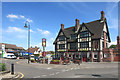
58 photos from this area
Area Information
Key information about the DA14 4RT including its size, population, and administrative classification.
- Area Type
- Postcode
- Area Size
- 1.2 hectares
- Population
- 1617
- Population Density
- 786 people/km²
House Prices in DA14 4RT
34
Properties
£181,500
Average Sold Price
£66,500
Lowest Price
£293,000
Highest Price
Showing 34 properties
| Address | Type | Beds | Baths | Last Sale Price | Last Sale Date | |
|---|---|---|---|---|---|---|
| 14 Ladbrooke Crescent, Sidcup, DA14 4RT | Retail | 2 | 1 | £285,000 | Aug 2022 | |
| 12 Ladbrooke Crescent, Sidcup, DA14 4RT | Flat | - | - | £292,000 | Mar 2022 | |
| 20 Ladbrooke Crescent, Sidcup, DA14 4RT | Maisonette | 2 | 1 | £293,000 | Dec 2018 | |
| 48 Ladbrooke Crescent, Sidcup, DA14 4RT | Maisonette | 2 | 1 | £185,000 | Dec 2013 | |
| 2 Ladbrooke Crescent, Sidcup, DA14 4RT | Flat | 2 | - | £180,000 | Nov 2011 | |
| 4 Ladbrooke Crescent, Sidcup, DA14 4RT | Maisonette | - | - | £170,000 | Aug 2011 | |
| 9 Ladbrooke Crescent, Sidcup, DA14 4RT | Flat | - | - | £205,000 | Aug 2009 | |
| 16 Ladbrooke Crescent, Sidcup, DA14 4RT | Maisonette | 2 | 1 | £139,995 | Jul 2009 | |
| 11 Ladbrooke Crescent, Sidcup, DA14 4RT | Flat | - | - | £245,000 | Aug 2007 | |
| 22 Ladbrooke Crescent, Sidcup, DA14 4RT | Maisonette | - | - | £141,500 | Nov 2003 |
Page 1 of 4
Energy Efficiency in DA14 4RT
Amenities
Schools
| Rank | School | Type | Entry gender | Ages |
|---|
Explore more schools in this area
Go to Schools tabDemographics
Household Size
Family (3-5 people)
most common
Accommodation Type
Houses
most common
Tenure
59
majority
Ethnic Group
White
most common
Religion
N/A
most common
Household Composition
N/A
most common
Age
47
median
Adults (30-64 years)
most common
Household Deprivation
N/A
with no deprivation
NS-SEC
29
in Lower managerial occupations
Explore more demographic insights in this area
Go to Demographics tabPlanning
Planning Constraints
- Flood RiskPremium
- Ramsar Wetland SitesPremium
- Area of Outstanding Natural BeautyPremium
- Protected Nature ReservePremium
- Protected WoodlandPremium