Area Overview for DA14 4PG
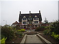
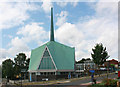
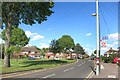
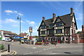
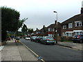
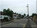
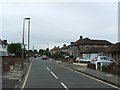
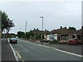
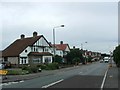
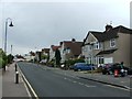
Photos of DA14 4PG


Area Information
Living in DA14 4PG means settling in a small, well-defined residential cluster in the London Borough of Bexley. With a population of 1,558, this area retains a suburban character shaped by 1930s development on former rural land. It lies 11.3 miles south-east of Charing Cross, placing it within commuting distance of central London while retaining a quieter, middle-class feel. The area’s history stretches back to Anglo-Saxon times, with notable landmarks like St John’s Church (1901) and the former Black Horse Inn, which once anchored local life. Today, residents benefit from proximity to rail networks, retail hubs, and the nearby London City Airport. The community is defined by 1930s housing estates such as Penhill Park and Albany Park, built by New Ideal Homesteads on former estates. Daily life here balances suburban tranquillity with access to urban amenities, making it appealing to commuters and families seeking a stable, low-risk environment.
- Area Type
- Postcode
- Area Size
- Not available
- Population
- 1558
- Population Density
- 5067 people/km²
The property market in DA14 4PG is dominated by owner-occupied homes, with 86% of residents living in properties they own. This high rate of home ownership suggests a stable, long-term community with limited rental activity. The area is primarily composed of houses, reflecting its suburban character and 1930s development origins. These homes are likely to be family-sized properties, given the median age of 47 and the prevalence of adult households. For buyers, this means a market focused on existing, well-established homes rather than new builds or rental properties. The small size of the area means that properties are likely to be in close proximity to local amenities, such as the Co-op Albany and Sidcup Station. However, the limited scale of the area may restrict the availability of larger or more diverse housing options. Buyers should consider the fixed broadband score of 100, which ensures excellent connectivity, and the low crime risk, making it an attractive option for those prioritising safety and stability.
House Prices in DA14 4PG
No properties found in this postcode.
Energy Efficiency in DA14 4PG
Residents of DA14 4PG have access to a range of amenities within practical reach. Retail options include Co-op Albany, Tesco Sidcup, and M&S Sidcup, providing everyday shopping convenience. The area’s proximity to ferry services like Woolwich Arsenal Pier and Barrier Gardens Pier adds to its connectivity, while rail and metro stations ensure easy access to London. For leisure, the area’s 1930s housing estates are surrounded by green spaces, though specific parks are not named in the data. The historical character of the area is reflected in landmarks like St John’s Church and the Hollies, a listed building with a clock tower. The presence of multiple transport hubs, combined with retail and dining options, creates a lifestyle that balances suburban comfort with urban accessibility. This mix of amenities supports a practical, community-oriented way of life, where daily needs can be met locally while maintaining links to the wider city.
Amenities
Schools
| Rank | School | Type | Entry gender | Ages |
|---|
Explore more schools in this area
Go to Schools tabDemographics
DA14 4PG’s population of 1,558 is predominantly composed of adults aged 30–64, with a median age of 47. This suggests a mature, established community with strong ties to the area. Home ownership is high at 86%, indicating a stable, long-term resident base rather than a transient rental market. The area is primarily composed of houses, reflecting a suburban layout typical of 1930s development. The predominant ethnic group is White, which aligns with the broader demographic profile of Bexley. This demographic profile suggests a community focused on family living, with limited diversity in terms of age or ethnicity. The low deprivation levels, inferred from high home ownership and stable housing, imply a quality of life characterised by security and access to essential services. However, the lack of statistical data on deprivation means this assessment is based on indirect indicators like property ownership and age distribution.
Household Size
Accommodation Type
Tenure
Ethnic Group
Religion
Household Composition
Age
Household Deprivation
NS-SEC
Explore more demographic insights in this area
Go to Demographics tabPlanning
Planning Constraints
- Flood RiskPremium
- Ramsar Wetland SitesPremium
- Area of Outstanding Natural BeautyPremium
- Protected Nature ReservePremium
- Protected WoodlandPremium