Area Overview for DA14 4NR
Photos of DA14 4NR
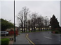
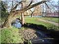
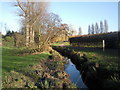
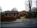
70 photos from this area
Area Information
Key information about the DA14 4NR including its size, population, and administrative classification.
- Area Type
- Postcode
- Area Size
- 1.5 hectares
- Population
- 1637
- Population Density
- 3025 people/km²
House Prices in DA14 4NR
53
Properties
£298,146
Average Sold Price
£68,000
Lowest Price
£549,000
Highest Price
Showing 53 properties
| Address | Type | Beds | Baths | Last Sale Price | Last Sale Date | |
|---|---|---|---|---|---|---|
| 44 Foots Cray Lane, Sidcup, DA14 4NR | Terraced | 3 | 1 | £435,000 | Jun 2025 | |
| 46 Foots Cray Lane, Sidcup, DA14 4NR | Terraced | 3 | 1 | £430,000 | Feb 2025 | |
| 78 Foots Cray Lane, Sidcup, DA14 4NR | house | - | - | £375,000 | Jan 2025 | |
| 86 Foots Cray Lane, Sidcup, DA14 4NR | Terraced | 3 | 1 | £510,000 | Jan 2024 | |
| 82 Foots Cray Lane, Sidcup, DA14 4NR | Terraced | 3 | 2 | £475,000 | May 2023 | |
| 2 Foots Cray Lane, Sidcup, DA14 4NR | Terraced | 4 | 1 | £440,000 | Mar 2023 | |
| 88 Foots Cray Lane, Sidcup, DA14 4NR | Terraced | 4 | 2 | £425,000 | Jan 2023 | |
| 100 Foots Cray Lane, Sidcup, DA14 4NR | house | - | - | £382,000 | Apr 2021 | |
| 22 Foots Cray Lane, Sidcup, DA14 4NR | house | - | - | £365,000 | Feb 2021 | |
| 10 Foots Cray Lane, Sidcup, DA14 4NR | house | - | - | £351,000 | Nov 2020 |
Page 1 of 6
Energy Efficiency in DA14 4NR
Amenities
Schools
| Rank | School | Type | Entry gender | Ages |
|---|
Explore more schools in this area
Go to Schools tabDemographics
Household Size
Family (3-5 people)
most common
Accommodation Type
Houses
most common
Tenure
93
majority
Ethnic Group
White
most common
Religion
N/A
most common
Household Composition
N/A
most common
Age
47
median
Adults (30-64 years)
most common
Household Deprivation
N/A
with no deprivation
NS-SEC
44
in Lower managerial occupations
Explore more demographic insights in this area
Go to Demographics tabPlanning
Planning Constraints
- Flood RiskPremium
- Ramsar Wetland SitesPremium
- Area of Outstanding Natural BeautyPremium
- Protected Nature ReservePremium
- Protected WoodlandPremium