Area Overview for DA1 4QL
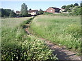
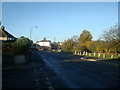
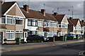
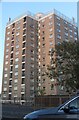
Photos of DA1 4QL


Area Information
Living in DA1 4QL means being part of a compact, residential cluster in the London Borough of Bexley, centred around Crayford. This area, spanning just 1.1 hectares, is home to 1,736 people, creating a densely populated yet manageable community. The postcode falls within Crayford Ward, a historic settlement with roots in the Anglo-Saxon era and a church recorded in the Domesday Book. Today, it balances heritage with modernity, supported by retail hubs like Sainsbury’s and the Tower Retail Park, which replaced a former Vickers armaments site. The area’s economy thrives on retail and commuter activity, with many residents working in London, Bexleyheath, or Bluewater. Daily life here is shaped by proximity to transport links, including five rail stations and ferry piers, and a mix of historic landmarks like St Paulinus Church. Despite its small size, DA1 4QL offers a blend of practicality and character, ideal for those seeking a connected yet low-density living environment.
- Area Type
- Postcode
- Area Size
- 1.1 hectares
- Population
- Not available
- Population Density
- Not available
The property market in DA1 4QL is defined by a 47% home ownership rate, with flats comprising the majority of housing stock. This suggests a mix of owner-occupied and rental properties, though the small area size means the housing stock is limited. The dominance of flats indicates a need for buyers to consider shared spaces and potential noise from communal areas. Given the high population density, properties here are likely to be compact, prioritising practicality over expansive layouts. For buyers, the area’s proximity to transport links and retail hubs may outweigh the limitations of flat living. However, the small footprint of DA1 4QL means the immediate surroundings, such as nearby Crayford or Bexleyheath, may offer more diverse housing options. Investors should note the balance between rental demand and the potential for long-term value appreciation in a well-connected commuter zone.
House Prices in DA1 4QL
No properties found in this postcode.
Energy Efficiency in DA1 4QL
DA1 4QL offers a practical lifestyle with access to essential amenities within reach. Retail options include Morrisons Daily, Budgens Slade, and Tesco Erith, catering to daily needs. The area’s transport links—rail, metro, and ferry—connect residents to broader networks, facilitating both local and long-distance travel. While the data does not specify parks or leisure facilities, the proximity to the River Cray and historic sites like St Paulinus Church suggests opportunities for outdoor activities. The local economy, centred on retail and commuter hubs, means the area is well-served by shops and services. However, the small size of DA1 4QL means residents may need to venture slightly further for more specialised amenities. The combination of transport options and retail access creates a functional environment, though the community’s character is defined by its compact, commuter-oriented nature.
Amenities
Schools
| Rank | School | Type | Entry gender | Ages |
|---|
Explore more schools in this area
Go to Schools tabDemographics
DA1 4QL’s population of 1,736 is concentrated in a 1.1-hectare area, resulting in a high population density of 154,425 people per square kilometre. The median age is 47, with the majority of residents aged between 30 and 64, reflecting a mature, stable community. Home ownership rates are 47%, indicating a mix of owner-occupied and rental properties. Flats are the predominant accommodation type, shaped by the area’s compact footprint. The predominant ethnic group is White, though specific data on diversity is not provided. The high population density suggests a tightly knit neighbourhood, where proximity to amenities and transport is both a convenience and a challenge. For residents, this density supports a vibrant local economy but may limit private outdoor space. The age profile suggests a community focused on stability, with many likely working in nearby industrial or retail sectors.
Household Size
Accommodation Type
Tenure
Ethnic Group
Religion
Household Composition
Age
Household Deprivation
NS-SEC
Explore more demographic insights in this area
Go to Demographics tabPlanning
Planning Constraints
- Flood RiskPremium
- Ramsar Wetland SitesPremium
- Area of Outstanding Natural BeautyPremium
- Protected Nature ReservePremium
- Protected WoodlandPremium