Area Overview for DA1 4FH
Photos of DA1 4FH
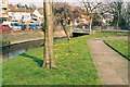
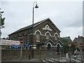
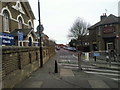
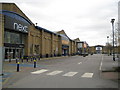
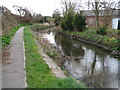
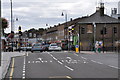
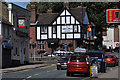
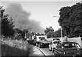
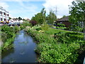
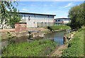
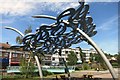
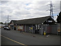
94 photos from this area
Area Information
Key information about the DA1 4FH including its size, population, and administrative classification.
- Area Type
- Postcode
- Area Size
- 2714 m²
- Population
- 1381
- Population Density
- 3638 people/km²
House Prices in DA1 4FH
82
Properties
£230,610
Average Sold Price
£92,750
Lowest Price
£304,000
Highest Price
Showing 82 properties
| Address | Type | Beds | Baths | Last Sale Price | Last Sale Date | |
|---|---|---|---|---|---|---|
| 8 Townhall Square, Crayford, Dartford, DA1 4FH | Flat | 2 | 2 | £260,000 | Dec 2025 | |
| 7 Townhall Square, Crayford, Dartford, DA1 4FH | Flat | - | - | £260,000 | Oct 2025 | |
| 34 Townhall Square, Crayford, Dartford, DA1 4FH | Flat | - | - | £265,000 | May 2025 | |
| 65 Townhall Square, Crayford, Dartford, DA1 4FH | Flat | - | - | £270,000 | Feb 2025 | |
| 45 Townhall Square, Crayford, Dartford, DA1 4FH | Flat | 2 | 2 | £255,000 | Nov 2024 | |
| 35 Townhall Square, Crayford, Dartford, DA1 4FH | Flat | - | - | £270,000 | Aug 2024 | |
| 47 Townhall Square, Crayford, Dartford, DA1 4FH | Flat | - | - | £250,000 | Jun 2024 | |
| 81 Townhall Square, Crayford, Dartford, DA1 4FH | Flat | - | - | £220,000 | May 2024 | |
| 22 Townhall Square, Crayford, Dartford, DA1 4FH | Flat | - | - | £252,000 | Apr 2024 | |
| 6 Townhall Square, Crayford, Dartford, DA1 4FH | Flat | - | - | £260,000 | Dec 2023 |
Page 1 of 9
Energy Efficiency in DA1 4FH
Amenities
Schools
| Rank | School | Type | Entry gender | Ages |
|---|
Explore more schools in this area
Go to Schools tabDemographics
Household Size
One person
most common
Accommodation Type
Flats
most common
Tenure
38
majority
Ethnic Group
White
most common
Religion
N/A
most common
Household Composition
N/A
most common
Age
47
median
Adults (30-64 years)
most common
Household Deprivation
N/A
with no deprivation
NS-SEC
28
in Lower managerial occupations
Explore more demographic insights in this area
Go to Demographics tabPlanning
Planning Constraints
- Flood RiskPremium
- Ramsar Wetland SitesPremium
- Area of Outstanding Natural BeautyPremium
- Protected Nature ReservePremium
- Protected WoodlandPremium