Area Overview for DA1 4DY
Photos of DA1 4DY
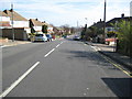


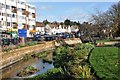

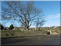
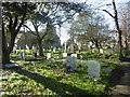

42 photos from this area
Area Information
Key information about the DA1 4DY including its size, population, and administrative classification.
- Area Type
- Postcode
- Area Size
- 7345 m²
- Population
- 1474
- Population Density
- 3424 people/km²
House Prices in DA1 4DY
29
Properties
£241,825
Average Sold Price
£37,500
Lowest Price
£490,000
Highest Price
Showing 29 properties
| Address | Type | Beds | Baths | Last Sale Price | Last Sale Date | |
|---|---|---|---|---|---|---|
| 130 Old Road, Crayford, Dartford, DA1 4DY | Terraced | 2 | 1 | £310,000 | Nov 2025 | |
| 144 Old Road, Crayford, Dartford, DA1 4DY | Terraced | 4 | 2 | £490,000 | Jun 2025 | |
| 172 Old Road, Crayford, Dartford, DA1 4DY | Flat | 1 | 1 | £245,000 | May 2025 | |
| 124 Old Road, Crayford, Dartford, DA1 4DY | Semi-detached | 3 | 1 | £395,000 | Sep 2024 | |
| 164 Old Road, Crayford, Dartford, DA1 4DY | Maisonette | 2 | 1 | £271,000 | Oct 2023 | |
| 176 Old Road, Crayford, Dartford, DA1 4DY | Flat | 1 | 1 | £210,000 | May 2023 | |
| 126 Old Road, Crayford, Dartford, DA1 4DY | Terraced | 1 | 1 | £400,000 | Oct 2022 | |
| 160 Old Road, Crayford, Dartford, DA1 4DY | Maisonette | 2 | 1 | £245,000 | Sep 2021 | |
| 154 Old Road, Crayford, Dartford, DA1 4DY | Terraced | 4 | 1 | £362,500 | Feb 2021 | |
| 158 Old Road, Crayford, Dartford, DA1 4DY | Flat | - | - | £250,000 | Jul 2019 |
Page 1 of 3
Energy Efficiency in DA1 4DY
Amenities
Schools
| Rank | School | Type | Entry gender | Ages |
|---|
Explore more schools in this area
Go to Schools tabDemographics
Household Size
Two person
most common
Accommodation Type
Houses
most common
Tenure
77
majority
Ethnic Group
White
most common
Religion
N/A
most common
Household Composition
N/A
most common
Age
47
median
Adults (30-64 years)
most common
Household Deprivation
N/A
with no deprivation
NS-SEC
36
in Lower managerial occupations
Explore more demographic insights in this area
Go to Demographics tabPlanning
Planning Constraints
- Flood RiskPremium
- Ramsar Wetland SitesPremium
- Area of Outstanding Natural BeautyPremium
- Protected Nature ReservePremium
- Protected WoodlandPremium