Area Overview for DA1 3RF
Photos of DA1 3RF


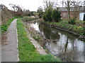


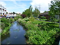
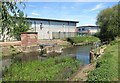

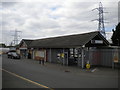
94 photos from this area
Area Information
Key information about the DA1 3RF including its size, population, and administrative classification.
- Area Type
- Postcode
- Area Size
- 5614 m²
- Population
- Not available
- Population Density
- Not available
House Prices in DA1 3RF
13
Properties
£390,577
Average Sold Price
£275,000
Lowest Price
£745,000
Highest Price
Showing 13 properties
| Address | Type | Beds | Baths | Last Sale Price | Last Sale Date | |
|---|---|---|---|---|---|---|
| 42 Woolbrook Road, Crayford, Dartford, DA1 3RF | Detached | 5 | 4 | £745,000 | Mar 2025 | |
| 54 Woolbrook Road, Crayford, Dartford, DA1 3RF | Detached | 4 | 2 | £687,500 | Jun 2023 | |
| 50 Woolbrook Road, Crayford, Dartford, DA1 3RF | Detached | 5 | 4 | £365,000 | Mar 2021 | |
| 56 Woolbrook Road, Crayford, Dartford, DA1 3RF | house | - | - | £360,000 | May 2010 | |
| 64 Woolbrook Road, Crayford, Dartford, DA1 3RF | house | - | - | £338,000 | May 2010 | |
| 60 Woolbrook Road, Crayford, Dartford, DA1 3RF | house | 3 | - | £350,000 | Mar 2010 | |
| 52 Woolbrook Road, Crayford, Dartford, DA1 3RF | Detached | - | - | £297,000 | Dec 2003 | |
| 46 Woolbrook Road, Crayford, Dartford, DA1 3RF | house | - | - | £275,000 | Dec 2003 | |
| 40 Woolbrook Road, Crayford, Dartford, DA1 3RF | Detached | - | - | £295,000 | Aug 2003 | |
| 58 Woolbrook Road, Crayford, Dartford, DA1 3RF | Detached | - | - | £320,000 | Jun 2003 |
Page 1 of 2
Energy Efficiency in DA1 3RF
Amenities
Schools
| Rank | School | Type | Entry gender | Ages |
|---|
Explore more schools in this area
Go to Schools tabDemographics
Household Size
Family (3-5 people)
most common
Accommodation Type
Houses
most common
Tenure
77
majority
Ethnic Group
White
most common
Religion
N/A
most common
Household Composition
N/A
most common
Age
47
median
Adults (30-64 years)
most common
Household Deprivation
N/A
with no deprivation
NS-SEC
39
in Lower managerial occupations
Explore more demographic insights in this area
Go to Demographics tabPlanning
Planning Constraints
- Flood RiskPremium
- Ramsar Wetland SitesPremium
- Area of Outstanding Natural BeautyPremium
- Protected Nature ReservePremium
- Protected WoodlandPremium