Area Overview for Cripplegate Ward
Photos of Cripplegate Ward

Area Information
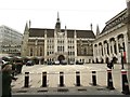
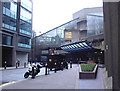
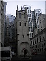
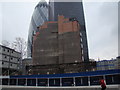
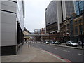
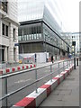
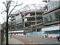
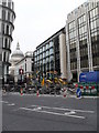
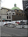
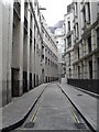
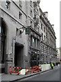
Cripplegate Ward sits in north-central London at 51.5203°N, 0.0939°W. It is one of the 25 ancient wards of the City of London, named after the former Cripplegate in the Roman city wall. The ward covers an area of 12.6 hectares. This location encompasses parts of both the historic core within the former city wall and areas that lie outside it. You can find Little Moorfields and Coleman Street Ward to the east of the borders. The history here is deep. Wards like this took shape in the 11th century before the Norman Conquest. Cripplegate Without was part of the Soke of Cripplegate held by St. Martin's Le Grand. Thomas More was born on Milk Street in 1478. The area was devastated during the Second World War. redevelopment as the Barbican Estate began in 1957 and opened in 1969. This evolution has shaped the streets you walk today. The name originates from the city gate, which was demolished in 1760. Now, the ward offers a specific urban experience in the heart of the capital. You live in a space where medieval history meets modern infrastructure. The boundaries remain fixed despite the changes over centuries. Living in Cripplegate Ward means you are connected to the ancient administrative structure of the City while enjoying the facilities of modern London. Understanding these boundaries helps you navigate the district effectively.
- Area Type
- District Borough Unitary Ward
- Area Size
- 12.6 hectares
- Population
- Not available
- Population Density
- Not available
Demographics
The community in Cripplegate Ward has a distinct age profile. The median age for residents is 70 years. This indicates a population that is largely composed of older adults. The most common age range data shows a focus on total age distribution trends. You should expect a quiet neighbourhood environment due to this demographic weighting. Home ownership stands at 37 per cent. This figure means that roughly six out of ten households do not own their property. Consequently, the rental sector plays a significant role in the local housing market. Household composition data categorises the total living arrangements within the ward. Accommodation types represent the total inventory available to residents. The data does not break down these types further, but the low ownership rate suggests a high concentration of tenants. Diversity metrics for the predominant ethnic group are not detailed in the available statistics. Religion data is also not specified for this ward. These gaps mean you must look to other sources for cultural details. However, the age profile offers a clear picture of daily life. You are likely to live near many retirees. This demographic reality affects local services, community groups, and the general pace of the area. Your neighbours here are likely to be older generations who have settled in this historic ward.
Household Size
Accommodation Type
Tenure
Ethnic Group
Religion
Household Composition
Age
Household Deprivation
NS-SEC
Explore more demographic insights in this area
Go to Demographics tabPlanning
Planning Constraints
- Flood RiskPremium
- Ramsar Wetland SitesPremium
- Area of Outstanding Natural BeautyPremium
- Protected Nature ReservePremium
- Protected WoodlandPremium