Area Overview for Cricklewood Ward
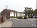
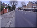
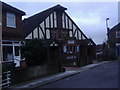
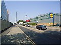
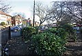
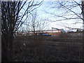
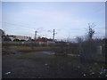
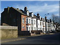
Photos of Cricklewood Ward


Area Information
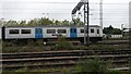
Cricklewood Ward is a compact district located entirely within 2.0 km² of North West London. This small borough unitary ward straddles the boundary between the London Borough of Barnet and the London Borough of Brent, anchored by the historic Edgware Road. The area derives its name from a nearby wood, reflecting its rural origins before rapid urbanisation transformed the landscape by the 19th century. Today, you will find a distinct residential character with deep historical roots in transport and industry, including the former locomotive works of the Midland Railway and the aerospace operations of the Handley Page Aircraft Company. Daily life here centres around the strategic location along Watling Street, offering immediate access to major rail lines at Cricklewood and Willesden Green stations. The ward retains significant heritage elements, such as the Crown Inn, which remains a local landmark, and Vernon Court, marked by a blue plaque commemorating aviation pioneer Amy Johnson. While the physical footprint is modest, the district housed diverse industries ranging from silent film production at Stoll Studios to precision instrument manufacturing. The area serves as a concentrated node in the wider metropolitan network, combining historical significance with practical connectivity for modern commuters.
- Area Type
- District Borough Unitary Ward
- Area Size
- 2.0 km²
- Population
- Not available
- Population Density
- Not available
Demographics
The community within Cricklewood Ward presents a clear demographic profile unlike many other urban zones. Data confirms that a significant portion of the population lives in older homes, with a median age of 70 years. This indicates that you are moving into an area where the majority of adults are nearly three times older than the average resident across the country. The census figures identify the total age grouping as the most common demographic recorded, suggesting a population heavily skewed toward retirement or later life stages compared to typical London wards. Home ownership rates stand at 36 per cent, meaning roughly one resident in three owns their property outright or with a mortgage. The remaining households consist of private and social renters, reflecting a significant tenant population. The ward does not feature protected nature reserves, protected woodland, or designated Ramsar wetland sites, so the local environment consists primarily of developed residential and commercial land uses. There is no Area of Outstanding Natural Beauty coverage within the boundary. While specific data on predominant ethnic groups and religious breakdowns is not detailed in the current census snapshot, the area functions as a defined residential settlement with a stable, albeit distinctly aged, social structure.
Household Size
Accommodation Type
Tenure
Ethnic Group
Religion
Household Composition
Age
Household Deprivation
NS-SEC
Explore more demographic insights in this area
Go to Demographics tabPlanning
Planning Constraints
- Flood RiskPremium
- Ramsar Wetland SitesPremium
- Area of Outstanding Natural BeautyPremium
- Protected Nature ReservePremium
- Protected WoodlandPremium
- Crime RiskPremium