Area Overview for Crayford Ward
Photos of Crayford Ward
Area Information
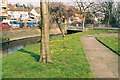
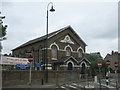
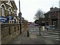
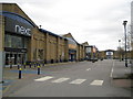
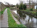
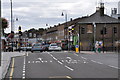
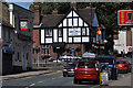
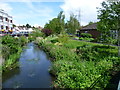
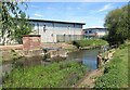
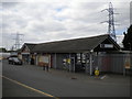
Crayford Ward is an electoral ward within the London Borough of Bexley in South East London, covering a substantial 5.1 km². Despite its size, the resident population stands at 1,381 people, creating a relatively open environment compared to denser London districts. This ward centres on the historic town of Crayford, named after its old ford across the River Cray first recorded in the Domesday Book of 1086. The area retains a connection to its deep past, with written history tracing back to the Anglo-Saxon Chronicle and prehistoric finds dating to 200,000 years ago. Local landmarks include the Norman St Paulinus Church, built around 1100 with twin naves, and Crayford Manor House, which sits on a 14th-century site. The modern economy revolves around retail trade, anchored by a large Sainsbury's hypermarket and the Tower Retail Park, which opened in 1999 on the former Vickers armaments site. Living in Crayford Ward offers access to these established commercial hubs while maintaining proximity to the commuter routes that have long supported the town's growth towards London, Bexleyheath, and Bluewater. The ward's identity is firmly rooted in its transition from industrial origins, characterised by early iron working and textile printing, to its current role as a service centre for the local borough.
- Area Type
- District Borough Unitary Ward
- Area Size
- 5.1 km²
- Population
- 1381
- Population Density
- 270 people/km²
Demographics
The community profile in Crayford Ward reveals an older demographic structure. The median age for residents is 70 years, with total age data highlighted as the most common range in the available records. This indicates a population skewed significantly towards older adults, suggesting a neighbourhood where retirement housing or family compounds may play a prominent role. Home ownership remains strong here, with 65 per cent of the population owning their property outright or with a mortgage. This high ownership rate often correlates with stability and long-term settlement in the ward. While specific breakdowns for household composition, predominant ethnic groups, and religious affiliations are part of the total recorded data, the explicit figures provided focus heavily on age and tenure. The low population density of 270 people per km² reinforces the sense of space within this 5.1 km² area. For those considering moving to Crayford Ward, the data points to a quieter, established community rather than a dynamic, mixed-age urban centre. The absence of younger age strata in the highlighted statistics suggests that new families or students might find fewer peer groups locally compared to surrounding wards with younger medians.
Household Size
Accommodation Type
Tenure
Ethnic Group
Religion
Household Composition
Age
Household Deprivation
NS-SEC
Explore more demographic insights in this area
Go to Demographics tabPlanning
Planning Constraints
- Flood RiskPremium
- Ramsar Wetland SitesPremium
- Area of Outstanding Natural BeautyPremium
- Protected Nature ReservePremium
- Protected WoodlandPremium
- Crime RiskPremium