Area Overview for Cranford Ward
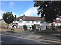
Photos of Cranford Ward
Area Information
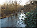
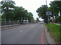
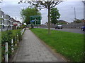
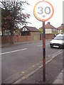
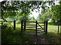
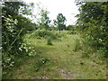
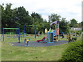
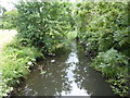
Cranford Ward OverviewYou will live in a compact suburban ward covering 3.2 square kilometres within the London Borough of Hounslow. This district currently accommodates a population of 2,026 people, resulting in a density of 643 people per square kilometre. Originally named from the Anglo-Saxon term for a ford of cranes, this area evolved from a Saxon settlement documented in the Domesday Book of 1086. Post-war developments, including the Parkway and the M4 motorway, have since reshaped the local landscape. These road networks severed the historic high street, creating a distinct separation between the village centre and surrounding residential zones. Despite this urban expansion, the ward retains significant green features, most notably Cranford Park. This conservation area protects historic landscape elements such as garden walls and an ice house. Living in Cranford Ward means residing in a former village now integrated into the suburban sprawl of Middlesex. The location sits approximately 12.5 miles west of Charing Cross, offering proximity to Heathrow Airport while maintaining a neighbourhood atmosphere. You can expect a community defined by its history as a crossroads for manors held by families like the Daundelyns and Cursons. The balance between historic charm and modern infrastructure characterises daily life here for both long-term residents and new arrivals.
- Area Type
- District Borough Unitary Ward
- Area Size
- 3.2 km²
- Population
- 2026
- Population Density
- 643 people/km²
Demographics
Community ProfileThe community in Cranford Ward is defined by an older demographic profile, with a median age of 70 years. This figure indicates that a significant portion of the local population comprises older adults. Home ownership stands at 39 per cent of the total households, meaning a majority of residents rent their properties. While the specific breakdown of household composition types is listed as total in the available records, the ownership rate suggests a market with strong tenancy or shared ownership dynamics. The area contains accommodation types that reflect its history of development since the 1950s and 1960s. Diversity data is recorded as total, indicating the need to refer to broader London statistics for precise ethnic and religious breakdowns. The presence of a low home ownership percentage may influence local investment patterns and rental availability. For those considering moving, the age profile suggests a quieter, possibly slower-paced neighbourhood compared to younger urban districts. The historical connection to the Berkeley family and the 1952 Cranford Agreement further contextualise the political and social fabric of this ward. These factors contribute to a stable, albeit somewhat ageing, resident base throughout the district.
Household Size
Accommodation Type
Tenure
Ethnic Group
Religion
Household Composition
Age
Household Deprivation
NS-SEC
Explore more demographic insights in this area
Go to Demographics tabPlanning
Planning Constraints
- Flood RiskPremium
- Ramsar Wetland SitesPremium
- Area of Outstanding Natural BeautyPremium
- Protected Nature ReservePremium
- Protected WoodlandPremium
- Crime RiskPremium