Area Overview for CR9 7AP
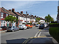
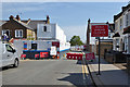
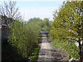
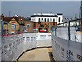
Photos of CR9 7AP


Area Information
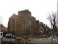
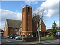
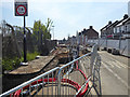
CR9 7AP is a small residential postcode area in the London Borough of Croydon, nestled in the northern part of Shirley. With a population of 1,876, it is a tight-knit community characterised by its historical roots and modern amenities. The area benefits from proximity to Shirley’s landmarks, including St John the Evangelist Church and the Shirley Windmill, both of which reflect the town’s Victorian heritage. Daily life here is shaped by a blend of suburban tranquillity and accessible urban connectivity. Residents enjoy a mix of local shops, transport links, and schools within walking or short-travel distance. The area’s compact size means it is well-suited for those seeking a balance between residential comfort and ease of access to Croydon’s broader offerings. With a median age of 47 and a population skewed towards adults aged 30–64, the community is stable and family-oriented. CR9 7AP’s appeal lies in its low flood risk, absence of environmental constraints, and proximity to both green spaces and urban infrastructure, making it a practical choice for buyers prioritising safety and convenience.
- Area Type
- Postcode
- Area Size
- Not available
- Population
- 1876
- Population Density
- 3787 people/km²
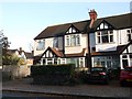
CR9 7AP is a small area with a housing stock dominated by houses, reflecting a preference for single-family homes over flats or apartments. With 50% of properties owner-occupied, the market is neither heavily rental-driven nor entirely focused on investment. This balance suggests a community of long-term residents rather than transient tenants. The compact size of the postcode means property availability is limited, and buyers should consider nearby areas for more options. The predominance of houses indicates a focus on family-friendly living, with larger spaces and private outdoor areas. However, the lack of specific data on property prices or recent transactions means buyers must conduct further local research. The area’s proximity to transport links and schools may enhance its appeal, but its small size means demand could outpace supply for certain property types.
House Prices in CR9 7AP
No properties found in this postcode.
Energy Efficiency in CR9 7AP
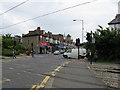
CR9 7AP offers a range of amenities within practical reach, enhancing daily life for residents. Local retail options include Tesco Croydon, Co-op 311 Lower, and Sainsburys Addiscombe, providing convenience for grocery shopping. The area’s tram and rail networks connect to key destinations, including Croydon’s town centre and London’s transport hubs. While there are no named parks or leisure facilities in the data, the proximity to Shirley’s historical sites, such as St John the Evangelist Church, adds cultural value. The presence of multiple airports nearby may cater to specific needs, though no recreational spaces are explicitly listed. Overall, the area’s amenities support a functional lifestyle, with a focus on practicality over extensive leisure options.
Amenities
Schools
Residents of CR9 7AP have access to two notable schools: Ashburton Community School, a primary institution, and Oasis Academy Shirley Park, an academy with a Good Ofsted rating. The presence of both a primary school and an academy provides families with a range of educational options, from early years to secondary education. Oasis Academy Shirley Park’s Good rating indicates a school delivering consistent quality in teaching and outcomes, which is a significant draw for families prioritising academic standards. The mix of school types ensures that children can transition smoothly from primary to secondary education within the area, reducing the need for long commutes. For parents, this combination of local and academy schools offers flexibility, whether they prefer a traditional primary setting or a more academically focused secondary environment.
| Rank | School | Type | Entry gender | Ages |
|---|
Explore more schools in this area
Go to Schools tabDemographics
CR9 7AP has a median age of 47, with the majority of residents falling within the 30–64 age range. This suggests a mature, established community with a focus on stability. Home ownership is at 50%, indicating a balanced mix of owner-occupied properties and rental units. The area is predominantly composed of houses, which contrasts with other parts of Croydon that may have more flats. The predominant ethnic group is White, reflecting the broader demographic trends in the borough. While specific data on deprivation is not provided, the absence of environmental planning constraints and the presence of essential amenities suggest a reasonably high quality of life. The age profile implies a population likely engaged in professional or semi-retired roles, with a focus on family living. This demographic structure supports a community with shared interests in local schools, green spaces, and accessible transport networks.
Household Size
Accommodation Type
Tenure
Ethnic Group
Religion
Household Composition
Age
Household Deprivation
NS-SEC
Explore more demographic insights in this area
Go to Demographics tabPlanning
Planning Constraints
- Flood RiskPremium
- Ramsar Wetland SitesPremium
- Area of Outstanding Natural BeautyPremium
- Protected Nature ReservePremium
- Protected WoodlandPremium