Area Overview for CR9 6HB
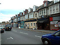
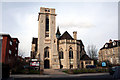
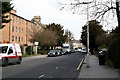
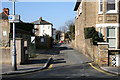
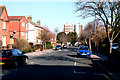
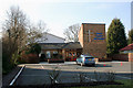
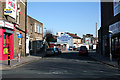
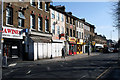
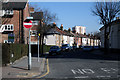
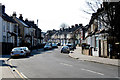
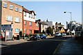
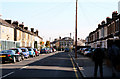
Photos of CR9 6HB
Area Information
CR9 6HB is a small, residential postcode area within the London Borough of Croydon, situated to the east of the town centre. It forms part of the Addiscombe West Ward, established in 2018, and includes parts of Addiscombe and East Croydon. The area has a population of 2,140, reflecting its compact, clustered nature. Historically, Addiscombe was shaped by the East India Company’s influence, with Victorian architecture preserved in the East India Estate Conservation Area. This area features streets named after figures from the East India Company, such as Canning Road and Havelock Road, alongside Grade II listed buildings like Heron’s Croft. While the retail hub of Addiscombe lies in a neighbouring ward, CR9 6HB offers a quieter, residential character. Its proximity to Croydon’s town centre and transport links makes it a practical choice for commuters, yet it retains a distinct identity rooted in its 19th-century heritage. The area’s small size means it is tightly integrated with surrounding neighbourhoods, creating a cohesive local community.
- Area Type
- Postcode
- Area Size
- Not available
- Population
- 2140
- Population Density
- 13099 people/km²
CR9 6HB is primarily a housing area with a focus on detached or semi-detached homes. The 39% home ownership rate indicates that more than half of properties are rented, suggesting a strong rental market. This dynamic may influence property values, with buyers potentially facing competition from tenants seeking long-term leases. The predominance of houses over flats or apartments reflects the area’s suburban character, appealing to families or those prioritising space. However, the small size of the postcode means the housing stock is limited, and buyers may need to consider nearby wards for more options. The lack of high-rise or commercial properties reinforces the area’s residential focus. For those seeking owner-occupation, the market may offer stability, but the rental demand could affect availability. The East India Estate’s conservation status may also influence property values, with historic features adding to their appeal.
House Prices in CR9 6HB
No properties found in this postcode.
Energy Efficiency in CR9 6HB
CR9 6HB offers a mix of retail, dining, and transport amenities within easy reach. Local shops include Co-op 61 Lower, Tesco Croydon, and Amazon Fresh, providing everyday essentials. The area’s tram and rail networks connect residents to Croydon’s town centre, where more extensive shopping and leisure options are available. While the data does not specify parks or leisure facilities, the East India Estate’s conservation status suggests a blend of historic architecture and green spaces. The presence of multiple transport stops and retail outlets contributes to a convenient, practical lifestyle. For those prioritising convenience, the area’s proximity to Croydon’s amenities balances with its residential tranquillity. The mix of independent schools and transport links also supports families seeking a blend of education and accessibility.
Amenities
Schools
CR9 6HB is served by three independent schools, all rated ‘good’ by Ofsted. Croydon Primary Independent School provides primary education, while Al-Khair School and Al-Khair Secondary Girls cater to secondary education. Independent schools often charge fees, though the data does not specify costs. The presence of two secondary schools for girls suggests a focus on single-sex education, which may appeal to families seeking specific educational environments. However, the absence of state schools means parents must consider the financial implications of private education. The ‘good’ Ofsted ratings indicate consistent quality, but the lack of state options may limit choices for those preferring free education. Families prioritising independent schooling will find the area well-served, but those seeking state-funded options may need to look further afield.
| Rank | School | Type | Entry gender | Ages |
|---|
Explore more schools in this area
Go to Schools tabDemographics
CR9 6HB has a median age of 47, with the majority of residents falling in the 30-64 age range. This suggests a community skewed towards middle-aged adults, likely including families and professionals. Home ownership accounts for 39% of properties, indicating a significant portion of the housing stock is rented. The predominant accommodation type is houses, which aligns with the area’s residential character. The predominant ethnic group is White, though no specific diversity statistics are provided. The age profile implies a stable, established population with limited presence of younger or older demographics. With 39% of homes owned by residents, the rental market is substantial, which may influence property prices and availability. The absence of detailed deprivation data means the area’s socioeconomic challenges cannot be quantified, but the age and ownership figures suggest a relatively mature, settled community.
Household Size
Accommodation Type
Tenure
Ethnic Group
Religion
Household Composition
Age
Household Deprivation
NS-SEC
Explore more demographic insights in this area
Go to Demographics tabPlanning
Planning Constraints
- Flood RiskPremium
- Ramsar Wetland SitesPremium
- Area of Outstanding Natural BeautyPremium
- Protected Nature ReservePremium
- Protected WoodlandPremium