Area Overview for CR9 4HH
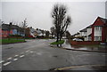
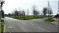
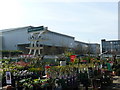
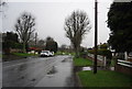
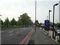
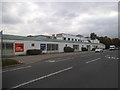
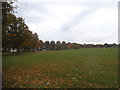
Photos of CR9 4HH


Area Information
CR9 4HH is a compact residential postcode in the London Borough of Croydon, nestled at the western edge of the town and bordering Sutton. The area covers 7,895 square metres and is home to 2,202 residents, making it one of the most densely populated zones in the borough. Historically a manor named from Old English, the area has evolved into a modern residential cluster with a mix of older and newer housing. Its proximity to Waddon railway station and Purley Way offers easy access to central London and surrounding suburbs. Daily life here is shaped by its compact size and proximity to amenities. The area’s character is defined by its blend of historic sites, such as Waddon Ponds, and contemporary infrastructure, including retail hubs like Costco Croydon. With a median age of 47 and a population skewed toward adults aged 30–64, the community reflects a balance of long-term residents and families seeking proximity to transport and schools.
- Area Type
- Postcode
- Area Size
- 7895 m²
- Population
- Not available
- Population Density
- Not available
CR9 4HH is a small area with a housing stock dominated by individual homes, though the 33% home ownership rate suggests that most properties are rented rather than owner-occupied. This dynamic may reflect the area’s appeal to renters seeking proximity to transport and amenities, or challenges in property affordability. The compact size of the postcode means the housing market is limited to a small number of properties, potentially increasing competition for buyers. For those considering purchase, the focus would likely be on existing homes rather than new developments. The area’s proximity to Waddon railway station and Purley Way may make it attractive to commuters, though the small size of the postcode means buyers may need to look beyond CR9 4HH for a broader selection of properties.
House Prices in CR9 4HH
No properties found in this postcode.
Energy Efficiency in CR9 4HH
Residents of CR9 4HH have access to a range of amenities within practical reach, including retail outlets such as Costco Croydon, Budgens Waddon, and Morrisons Waddon. These stores cater to everyday needs, from groceries to household essentials. The area’s proximity to Wandle Park offers recreational space, a historic site that has been refurbished with public funds. Nearby, the Waddon Ponds provide a green space with historical significance, adding to the area’s appeal. The mix of retail, green spaces, and transport links creates a convenient lifestyle, balancing urban accessibility with pockets of nature. The presence of multiple tram and rail stops ensures easy movement to other parts of Croydon and beyond, supporting both daily errands and weekend excursions.
Amenities
Schools
Residents of CR9 4HH have access to two primary schools: Waddon Infant School and Harris Primary Academy Purley Way, which holds an Ofsted rating of outstanding. These institutions cater to younger children, providing a foundation for education within the area. The presence of a high-rated primary school is a key consideration for families, though the absence of secondary schools in the immediate vicinity means parents may need to seek options further afield. The mix of schools reflects a focus on early education, which aligns with the area’s demographic profile of adults aged 30–64, many of whom may be parents. For families prioritising quality education, the outstanding rating at Harris Primary Academy Purley Way is a significant advantage.
| Rank | School | Type | Entry gender | Ages |
|---|
Explore more schools in this area
Go to Schools tabDemographics
The population of CR9 4HH is predominantly adults aged 30–64, with a median age of 47. This suggests a community of established professionals and families, though the 33% home ownership rate indicates that a significant portion of residents rent their homes. The area is primarily composed of houses, though the low ownership rate implies a reliance on rental properties. The predominant ethnic group is White, though specific data on diversity or deprivation is not provided. The age profile suggests a stable, mature population, but the relatively low home ownership may reflect economic or housing market pressures. For buyers, this dynamic could mean a competitive rental market and a need to consider long-term affordability. The absence of detailed diversity data means the community’s full demographic makeup remains partially opaque.
Household Size
Accommodation Type
Tenure
Ethnic Group
Religion
Household Composition
Age
Household Deprivation
NS-SEC
Explore more demographic insights in this area
Go to Demographics tabPlanning
Planning Constraints
- Flood RiskPremium
- Ramsar Wetland SitesPremium
- Area of Outstanding Natural BeautyPremium
- Protected Nature ReservePremium
- Protected WoodlandPremium