Area Overview for CR9 4DL
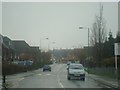
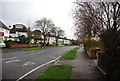
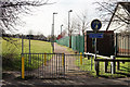
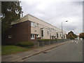
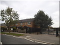
Photos of CR9 4DL


Area Information
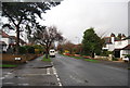
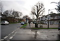
CR9 4DL is a compact residential postcode in the London Borough of Croydon, covering 8,698 square metres and home to 2,202 residents. Its population density of 253,147 people per square kilometre reflects its small, tightly knit character, typical of inner London. Historically a manor dating to the 12th century, the area is defined by its proximity to Waddon railway station and the Purley Way motorway, offering easy access to Croydon’s urban core and beyond. The postcode overlaps with parts of Waddon, South Croydon, and Haling Park, blending historic sites like Waddon Ponds with modern amenities. Daily life here is shaped by its proximity to retail hubs, public transport, and green spaces, though the area’s small size means its character is largely defined by its immediate surroundings. Living in CR9 4DL offers a mix of convenience and historical depth, with a focus on connectivity and practicality for residents.
- Area Type
- Postcode
- Area Size
- 8698 m²
- Population
- Not available
- Population Density
- Not available
CR9 4DL’s property market is characterised by a low home ownership rate (33%) and a predominance of houses. This suggests that the area is more rental-focused than owner-occupied, which may reflect its compact size and the nature of its housing stock. The presence of houses rather than flats or apartments indicates a mix of older, larger properties, possibly including semi-detached or detached homes. Given the small area size and high population density, the immediate surroundings likely offer limited additional housing options, making this postcode a niche market for buyers seeking specific properties. For those considering purchase, the low home ownership rate implies competition from renters, and the need to scrutinise property availability closely. The area’s proximity to transport links and amenities may also make it attractive to investors, though the small footprint means opportunities are constrained.
House Prices in CR9 4DL
No properties found in this postcode.
Energy Efficiency in CR9 4DL
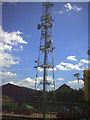
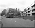
Living in CR9 4DL offers access to a range of amenities within practical reach. Retail options include Budgens Waddon, Morrisons Waddon, and Costco Croydon, catering to daily shopping needs. Public transport is extensive, with rail and metro stations providing links to Croydon and beyond. Green spaces such as Wandle Park, opened in 1890, and Waddon Ponds, a protected historic site, offer recreational opportunities. The area’s character is shaped by its blend of historic sites like Waddon Hotel and modern infrastructure, creating a mix of convenience and heritage. The presence of the Waddon Ponds estate and nearby Haling Manor adds to the local identity, while the proximity to Purley Way ensures easy access to larger urban amenities. This balance of parks, shops, and transport makes daily life in CR9 4DL both practical and varied.
Amenities
Schools
CR9 4DL is served by two primary schools: Waddon Infant School and Harris Primary Academy Purley Way. The latter holds an outstanding Ofsted rating, a rare distinction that highlights its quality of education. The presence of both infant and primary schools caters to families with children of different ages, reducing the need for long commutes to secondary education. However, no secondary schools are listed in the data, meaning families may need to look beyond the immediate area for older children’s schooling. The mix of school types suggests a focus on early education, which could be a draw for families prioritising primary schooling. For prospective buyers, the availability of a high-rated primary school may be a key consideration, though the lack of secondary options should be factored into long-term planning.
| Rank | School | Type | Entry gender | Ages |
|---|
Explore more schools in this area
Go to Schools tabDemographics
The population of CR9 4DL has a median age of 47, with the majority of residents aged 30–64. This suggests a community skewed towards middle-aged adults, likely reflecting long-term residents and families. Home ownership rates are low at 33%, indicating that most households are renters rather than property owners. The predominant accommodation type is houses, which is unusual for a high-density area, hinting at a mix of older, larger properties. The predominant ethnic group is White, though no data on diversity or deprivation levels is provided. The high population density, combined with a median age that leans towards older adults, may influence the area’s social dynamics, potentially creating a more stable, established community. However, the lack of data on income or deprivation means the full picture of quality of life remains incomplete.
Household Size
Accommodation Type
Tenure
Ethnic Group
Religion
Household Composition
Age
Household Deprivation
NS-SEC
Explore more demographic insights in this area
Go to Demographics tabPlanning
Planning Constraints
- Flood RiskPremium
- Ramsar Wetland SitesPremium
- Area of Outstanding Natural BeautyPremium
- Protected Nature ReservePremium
- Protected WoodlandPremium