Area Overview for CR9 3YR
Photos of CR9 3YR

Area Information
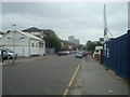
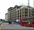
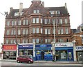
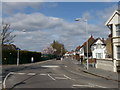
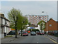
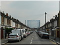
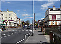
Living in CR9 3YR means being part of a compact, urban residential cluster in the London Borough of Croydon. With a population of 2,194, this postcode area sits at the intersection of Croydon’s retail core and the northern Purley Way corridor. Historically a hamlet around a triangular green on the London-Croydon road, the area has evolved into a densely populated neighbourhood. Its proximity to key transport hubs like West Croydon Station and East Croydon Railway Station makes it a convenient base for commuters. The area’s redevelopment in the early 20th century, including Royal Parade and Nova Road, reflects its layered history. Today, CR9 3YR offers a mix of modern living and historical traces, with retail and transport networks within walking distance. For those seeking a balance between urban convenience and a sense of community, this area’s compact layout and access to amenities make it a practical choice.
- Area Type
- Postcode
- Area Size
- Not available
- Population
- 2194
- Population Density
- 11041 people/km²
The property market in CR9 3YR is characterised by a low home ownership rate (22%) and a prevalence of flats. This suggests that the area functions more as a rental market than an owner-occupied one, with limited opportunities for buyers seeking to purchase property. The dominance of flats indicates a housing stock designed for urban living, often in multi-unit buildings. For buyers, this means competition for available properties and a focus on rental yields for investors. The small size of the postcode area means that the immediate surroundings, such as Purley Way and Croydon’s retail core, are critical for expanding property search criteria. Buyers should consider the area’s compact nature and its reliance on nearby amenities when evaluating long-term viability.
House Prices in CR9 3YR
No properties found in this postcode.
Energy Efficiency in CR9 3YR
CR9 3YR offers a convenient lifestyle with retail, transport, and leisure options within easy reach. The area’s proximity to Sainsburys Croydon West, M&S Mitcham Rd BP, and Lidl Broad ensures access to essential shopping and dining. Rail and metro stations, including West Croydon Station and Centrale Tram Stop, provide efficient links to London’s broader transport network. While the area itself is small, its integration with Croydon’s retail core and Purley Way means residents can access a wider range of amenities. The historical redevelopment of Royal Parade and Nova Road adds a layer of urban character, blending modern convenience with architectural heritage. For those valuing accessibility, CR9 3YR delivers a compact yet well-connected environment.
Amenities
Schools
| Rank | School | Type | Entry gender | Ages |
|---|
Explore more schools in this area
Go to Schools tabDemographics
CR9 3YR has a median age of 47, with the majority of residents falling in the 30-64 age range. This suggests a community of middle-aged adults, many of whom may be working professionals or families. Home ownership is relatively low at 22%, indicating that a significant portion of the population rents their homes. The predominant accommodation type is flats, reflecting a housing stock tailored to urban living. The area’s predominant ethnic group is Black residents, highlighting its cultural diversity. While no specific deprivation data is provided, the demographic profile suggests a stable, mature population with established ties to the area. This age group often prioritises proximity to transport and services, which aligns with the area’s retail and rail connectivity.
Household Size
Accommodation Type
Tenure
Ethnic Group
Religion
Household Composition
Age
Household Deprivation
NS-SEC
Explore more demographic insights in this area
Go to Demographics tabPlanning
Planning Constraints
- Flood RiskPremium
- Ramsar Wetland SitesPremium
- Area of Outstanding Natural BeautyPremium
- Protected Nature ReservePremium
- Protected WoodlandPremium