Area Overview for CR9 2RT
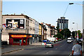
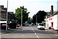
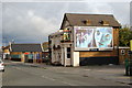
Photos of CR9 2RT


Area Information
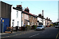
CR9 2RT lies in the London Borough of Croydon, part of a small residential cluster within the Broad Green ward. This area, once a hamlet of cottages around a triangular green on the London-Croydon road, is now a densely populated urban locality. With a population of 2,097, it sits at the northern edge of Croydon’s retail core, near Purley Way, and borders the London Boroughs of Sutton and Merton. The area’s history is rooted in 19th-century redevelopment, with roads like Nova Road and Royal Parade built during the early 1900s. Today, it is a compact, accessible neighbourhood with a mix of modern and historic features. Residents benefit from proximity to Croydon’s transport hubs and retail centres, while the area’s compact size means amenities are within practical reach. Living here offers a blend of urban convenience and a sense of community, though the small footprint means the character of the area is defined by its immediate surroundings.
- Area Type
- Postcode
- Area Size
- Not available
- Population
- 2097
- Population Density
- 14695 people/km²
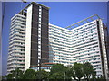
CR9 2RT’s property market is characterised by a low home ownership rate of 34%, with flats being the primary accommodation type. This suggests a rental-dominated market, where owner-occupation is less common. The prevalence of flats indicates a focus on compact, urban living, typical of Croydon’s residential clusters. For buyers, this means the area is unlikely to offer large detached homes, with properties likely to be smaller, multi-bedroom flats. The small size of the postcode area also limits the availability of diverse housing stock. Prospective buyers should consider that the market may cater more to renters or those seeking investment opportunities in flats. The flat-centric nature of the area aligns with its proximity to transport links and retail hubs, making it appealing for commuters or those prioritising convenience over spacious living.
House Prices in CR9 2RT
No properties found in this postcode.
Energy Efficiency in CR9 2RT
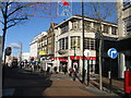
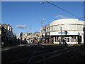
CR9 2RT offers a range of amenities within practical reach, enhancing daily life for residents. The area is served by five retail venues, including major supermarkets like Tesco Croydon and Lidl Broad, ensuring easy access to groceries and everyday essentials. Transport links are extensive, with five rail stations and three metro tram stops providing seamless connections to Croydon’s core and beyond. While parks or green spaces are not explicitly mentioned in the data, the area’s proximity to Croydon’s retail and transport hubs suggests a focus on urban convenience rather than natural landscapes. The presence of multiple retail and transport options means residents can shop, commute, and access services without needing to travel far. This accessibility contributes to a practical, efficient lifestyle, though the lack of specific mention of leisure or recreational facilities may indicate a more utilitarian approach to amenities.
Amenities
Schools
The nearest school to CR9 2RT is Harris Invictus Academy Croydon, an academy with an outstanding Ofsted rating. This institution provides a high standard of education, making it a strong draw for families. As an academy, it operates independently of local authority control, often with a focus on specialist subjects or high academic achievement. The presence of a single outstanding school in the area suggests a concentration of educational resources, though no other schools are listed in the data. For families prioritising quality education, this school is a key asset. However, the lack of additional schools may mean limited options for younger children or those seeking alternative educational approaches. The academy’s rating reflects a commitment to excellence, which could be a decisive factor for homebuyers with school-aged children.
| Rank | School | Type | Entry gender | Ages |
|---|
Explore more schools in this area
Go to Schools tabDemographics
The population of CR9 2RT has a median age of 47, with the most common age range being adults aged 30–64. This suggests a mature, stable community with a focus on established households. Home ownership accounts for 34% of properties, indicating a mix of owner-occupied and rental homes. The predominant accommodation type is flats, reflecting the area’s compact, urban layout. The predominant ethnic group is Black, though no specific data on diversity beyond this category is provided. The relatively low home ownership rate may suggest a higher proportion of renters, which could influence the local rental market. The age profile implies a community with a strong presence of middle-aged residents, potentially including families and professionals. While no specific deprivation data is given, the age and housing composition may indicate a balance between stability and affordability in the area.
Household Size
Accommodation Type
Tenure
Ethnic Group
Religion
Household Composition
Age
Household Deprivation
NS-SEC
Explore more demographic insights in this area
Go to Demographics tabPlanning
Planning Constraints
- Flood RiskPremium
- Ramsar Wetland SitesPremium
- Area of Outstanding Natural BeautyPremium
- Protected Nature ReservePremium
- Protected WoodlandPremium