Area Overview for CR9 2LW
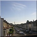
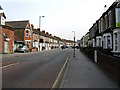
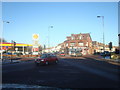
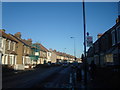
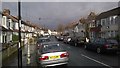
Photos of CR9 2LW


Area Information
Living in CR9 2LW means being part of a small residential cluster in the London Borough of Croydon, a suburb with historical roots and modern convenience. The area’s population of 1,510 reflects a compact community, shaped by its proximity to Selhurst railway station, which opened in 1865. The name “Selhurst” derives from Old English, signifying a dwelling near woodlands or willows, a legacy of its past as a rural settlement. Today, it is integrated into Croydon’s urban fabric, with easy access to transport links and local amenities. The area’s character blends historical context with contemporary living, offering a quieter alternative to Croydon’s busier zones. Residents benefit from proximity to primary and secondary schools, retail hubs, and public transport, making it appealing for families and professionals. While the postcode sector CR0 includes CR9 2LW, the area’s small size means it is tightly knit, with a focus on practicality and accessibility for daily life.
- Area Type
- Postcode
- Area Size
- Not available
- Population
- Not available
- Population Density
- Not available
The property market in CR9 2LW is characterised by a high proportion of rental properties, with only 35% of homes owned by residents. The area’s accommodation type is predominantly flats, reflecting its small scale and density. This suggests that the market is more suited to renters than buyers seeking owner-occupied homes. The limited number of owner-occupied properties may make it challenging for prospective buyers to find long-term investment opportunities. However, the presence of flats could appeal to those prioritising convenience and proximity to amenities. Given the area’s size, property choices are constrained, and buyers may need to consider nearby areas for more options. The market’s rental focus may also influence local dynamics, with landlords and tenants forming a significant part of the community.
House Prices in CR9 2LW
No properties found in this postcode.
Energy Efficiency in CR9 2LW
The lifestyle in CR9 2LW is shaped by its proximity to essential amenities. Residents have access to five retail outlets, including Co-op Selhurst and Tesco Croydon, ensuring convenience for grocery shopping and daily needs. The area’s transport links, such as Selhurst Station and multiple tram stops, provide easy access to Croydon’s broader network, enabling quick travel to workplaces, leisure spots, or further afield. While parks and leisure facilities are not explicitly listed, the presence of nearby schools and retail hubs suggests a focus on practical living. The area’s character is defined by its compactness, where daily life revolves around local shops, public transport, and community spaces. This setup caters to those prioritising accessibility and simplicity, though larger recreational areas may require venturing slightly beyond the postcode.
Amenities
Schools
Residents of CR9 2LW have access to a range of primary and secondary schools. Selhurst Mathematics and Computing Specialist School serves as a primary institution, while the BRIT School for Performing Arts and Technology is a secondary school with an outstanding Ofsted rating. Selhurst Boys’ High School and The Crescent Primary School also cater to primary education, with the latter holding a good Ofsted rating. This mix of school types provides families with options for both academic and creative education. The presence of a high-performing secondary school may be particularly appealing for parents seeking quality education. However, the concentration of primary schools suggests that secondary education may require commuting to nearby areas. The variety of schools reflects the area’s role as a residential hub for families.
| Rank | School | Type | Entry gender | Ages |
|---|
Explore more schools in this area
Go to Schools tabDemographics
CR9 2LW has a median age of 47, with the majority of residents falling in the 30–64 age range. This suggests a community skewed toward adults, possibly reflecting a mix of long-term residents and families. Home ownership rates are relatively low at 35%, indicating that a significant portion of the population lives in rental properties. The predominant accommodation type is flats, which aligns with the area’s compact nature and limited space for larger homes. The predominant ethnic group is Black residents, though specific figures on diversity are not provided. This demographic profile implies a community that is likely stable and mature, with a focus on established households. The lower home ownership rate may suggest a reliance on rental markets, which could influence local property dynamics and affordability.
Household Size
Accommodation Type
Tenure
Ethnic Group
Religion
Household Composition
Age
Household Deprivation
NS-SEC
Explore more demographic insights in this area
Go to Demographics tabPlanning
Planning Constraints
- Flood RiskPremium
- Ramsar Wetland SitesPremium
- Area of Outstanding Natural BeautyPremium
- Protected Nature ReservePremium
- Protected WoodlandPremium